94.5 inches is the amount of snow that I have measured so far this season. This takes into account what has amounted to a snowy week for much of northeastern Colorado and the Front Range Foothills. Just in the past 8 days, I have measured 23.7 inches of new snow (and we missed out on the big totals from last Friday’s storm). My ten year average snowfall for February is 27.8 inches – we are not that far from hitting that mark, and it is only February 11th.
The cold front on Sunday and the one that came through Monday evening both produced decent snowfall totals for relatively weak systems. Sunday’s storm brought 5.0 inches while Monday’s system produced 6.3 inches. On top of that, the liquid equivalent of all of the snow on the ground is hovering around 1.55 inches. When that melts, it will add some much needed moisture to the soil.
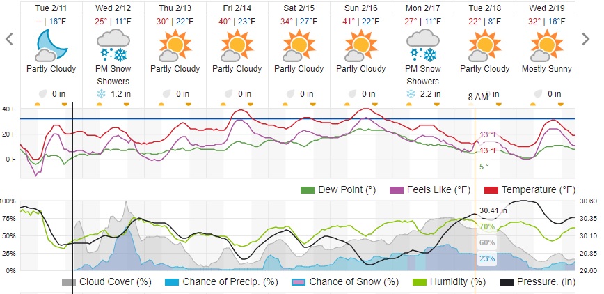
Yet another cold front will sweep across northeastern Colorado on Wednesday. This system appears to be the weakest of the past three, but it could muster out enough upslope flow and forcing to produce 1 to 3 inches, primarily to the east of the Peak to Peak Highway on Wednesday evening. After that, it appears that we will get a much deserved break from all of this snow. The Weather Underground forecast shows slightly warmer temperatures later this week and predominantly dry conditions:
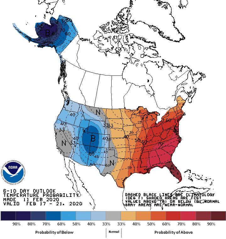
It does appear that there will be a cool down for the beginning of next week, and the Climate Prediction Center’s 6 to 10 day outlook shows this well:
Despite this return to cooler temperatures there are no big storms in sight!
The skiing is great right now! Enjoy the snow – hopefully this snowy pattern will continue into this spring!