As of this writing on Sunday night at 10 PM the temperature is 59 F here in the Saint Anton Highlands subdivision, just a little east of Nederland, Colorado. Mild temperatures and dry conditions will prevail over the Northern Front Range Foothills over the next several days.

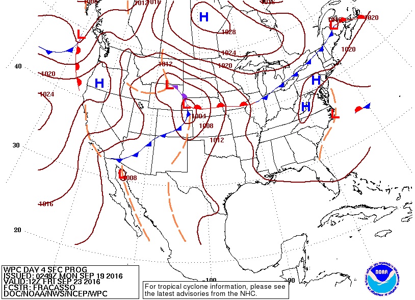
The surface map for midday Monday shows little in the way of moisture over much of the Western US. An upper level storm system, or a trough in meteorology-speak, will slowly sink southward off of the Washington, Oregon, and Northern California coasts through the middle of the week. This storm system will bring precipitation to the Great Basin, but Colorado will remain under a warm and stable bubble of air at least into Thursday. This storm system will shift eastward and be in our neck of the woods by Friday bringing with it cooler temperatures. Much of the moisture and energy associated with this storm will pass to our north, so there will be little in the way of precipitation. However, by the weekend, temperatures will be pleasantly cool, a reminder that Fall is here.
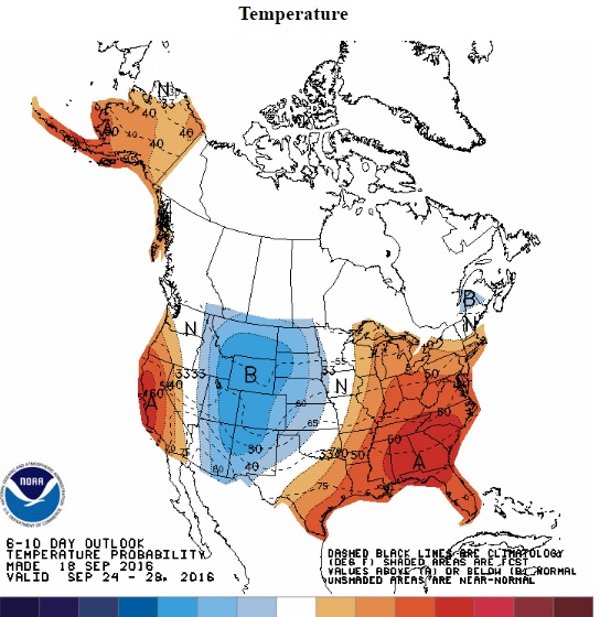
Looking further ahead, the Climate Prediction Center is showing that the below normal temperatures will remain with us at least into early next week.