Temperatures on Saturday were about 7 degrees cooler than on Friday with highs only (“only”) around 80 F. This was the result of a shallow pool of slightly cooler air settling over the high plains east of the Continental Divide. While there was an increase in moisture, atmospheric stability prevailed, and it remained dry and mostly sunny.
It is July, and it is warm. What is missing from the forecast is the monsoon, a seasonal push of moisture that results in summertime showers and thunderstorms in the central and southern Rockies. However, a slightly stronger push of cooler air may bring a better chance of afternoon and evening rain, especially on Monday and Tuesday. The nice thing about clouds and precipitation in the summer is that they help to make temperatures more comfortable. The NAM and GFS models differ in the amount of instability and energy that will be available to fuel thunderstorms early next week, but any rain that does fall will bring welcome relief to what has been a fairly dry month so far.
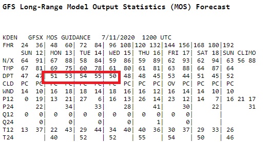
The GFS MOS does show dew points over 50 F early next week. This is usually a pretty good rule of thumb for forecasting at least a change of rain in Nederland and the surrounding Foothills communities:
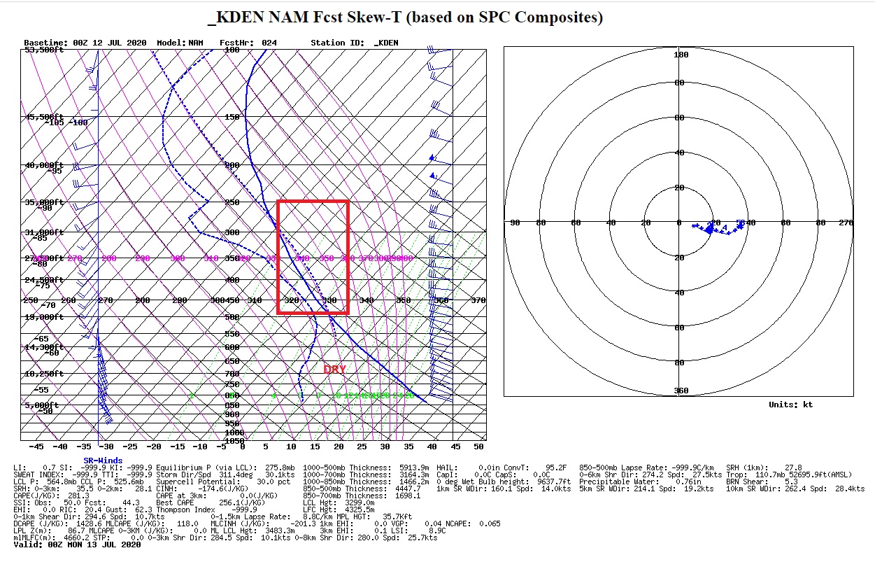
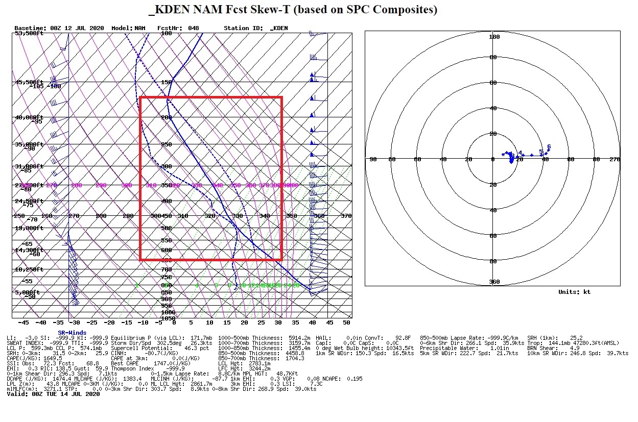
The sounding for Sunday evening (above) shows very little instability (in the red box) and plenty of dry air in the lower atmosphere. However, by Monday evening, there is much more instability:
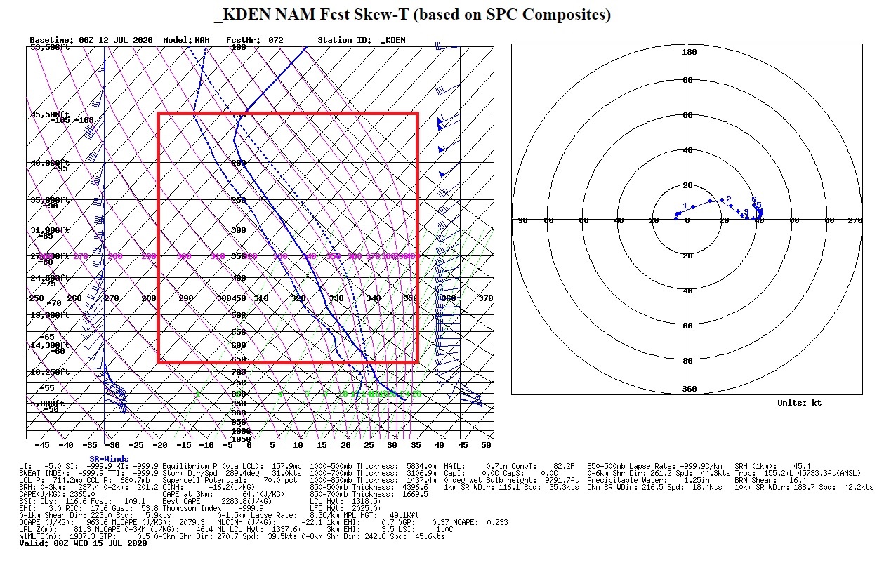
And then by Tuesday evening, there is an incredible amount of instability (lifted index down to -5) and moisture (precipitable water values up to 1.25 inches):
The one thing that will reduce the risk of flooding is that fact that these storms will be fast movers.
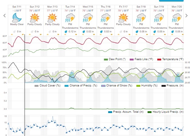
Here is the latest forecast from Weather Underground:
Let’s hope for some rain! The woods around Ned are getting dry, and we are under a level 2 fire ban.