We are quickly heading toward what is normally a quieter time of year weather-wise here in the Colorado Front Range Foothills. Late December and January are typically one of the driest times of the year for Nederland and the surrounding Foothills communities. There have been a few large snowstorms in northeastern Colorado in late December, but far and wide, January is a pretty dry month. From my 10 years of records, Nederland’s average January monthly snowfall is 15.3 inches:
| Total Snowfall (in) | Year |
|---|---|
| 22.7 | 2019 |
| 10.6 | 2018 |
| 28.8 | 2017 |
| 7.8 | 2016 |
| 11.8 | 2015 |
| 28.3 | 2014 |
| 3 | 2013 |
| 11.2 | 2012 |
| 12 | 2011 |
Most of January snowstorms have been 9 inches or less. The one exception was January 4-5, 2017 when we had 18.1 inches. There are a number of reasons why January is a drier month:
- Cold air masses in the middle part of the country (i.e. the Great Plains) effectively cut off any moisture from the Gulf of Mexico, which can be a significant source of moisture for Front Range weather events
- It is colder in general, and the saturation vapor pressure is much lower when it is colder. Note that it is incorrect to say cold air holds less moisture. It is more correct to say that the saturation vapor pressure of water is lower when it is colder. Hence, when saturation is achieved when it is very cold,there is less moisture available to produce precipitation.
- The storms that tend to affect the southern Rockies in January are Pacific storms, and after crossing several mountain ranges between the West Coast and Colorado, there is little moisture left to produce snow in the Front Range Foothills (January 4-5, 2017 was a big exception to this)
- Cutoff lows tend to track well to our south. These are the storms which can bring moist, easterly upslope flow to the Front Range. We don’t get this necessary ingredient for big snow when these lows are tracking across northern Mexico.
The ingredients for big upslope snows just do not tend to come together for us in January. There are always exceptions, but from a climatological point of view, January is a drier month.
We also tend to see positive PNA setups in January. Simply put, this means the colder air and storminess tend to focus on the eastern United States. Often a ridge builds up over the west resulting in weeks of drier and warmer weather.
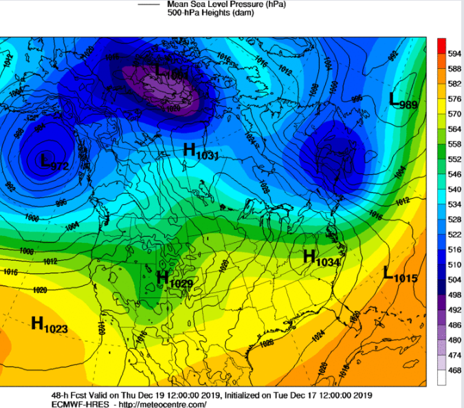
In the short term a ridge of high pressure will build up over the West on Wednesday:

The shortwave through over northern California on Wednesday morning will cut over the top of this ridge on on Thursday, bringing some clouds and cooler temperatures to Colorado:
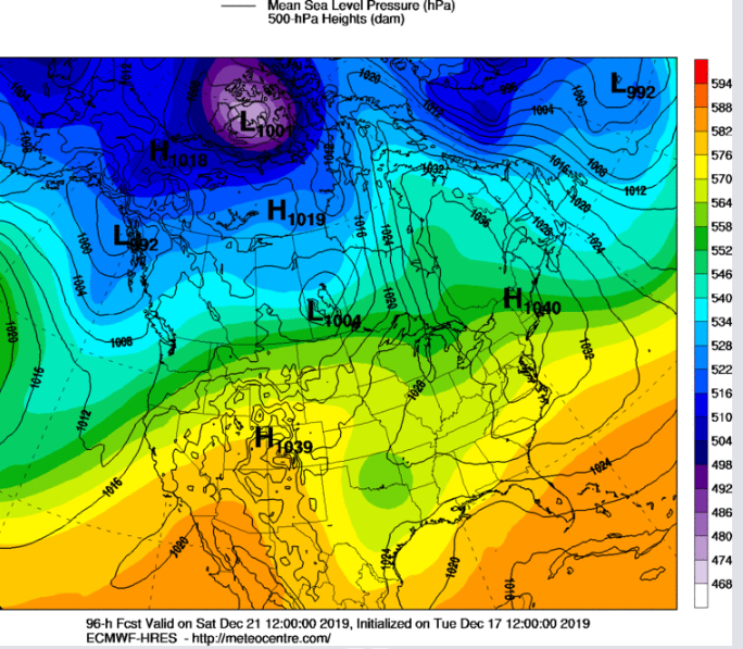
By this weekend, the ridge will reestablish itself over the Rockies, bringing milder temperatures:
Overall, we will be seeing some really nice and well-deserved mild weather this weekend. Here is the forecast from Weather Underground:
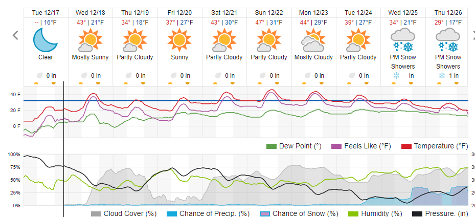
Despite the mild temperatures this weekend, I still think northern facing slopes and wooded areas around Ned will retain their snowpack, and this should ensure a white Christmas for those areas. Southern facing slopes should melt out in the abundant sunshine, But maybe there will be a little snow on Christmas…