The cold air pushed into the Front Range Foothills from the east this evening, and it came in much stronger and sooner than I thought it would. As of 9 PM this evening we are already down to -1 F. The temperature plot from my weather station shows that a nearly 25 F temperature drop occurred between 3 and 4 PM:
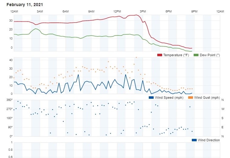
Notice, too, that the gusty west winds were replaced by lighter northeasterly winds around that time.
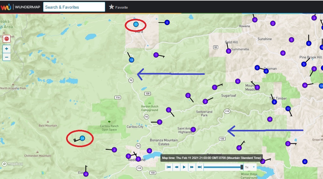
I’ve been watching the Weather Underground temperature map for Ned this evening. It has been interesting watching the cold air push in from the east and deepen. It reached our house around 3 PM. It didn’t reach Ned, 4 miles to our west, until 6 PM. Eldora started to cool down around 8 PM. As of 9 PM, the top of this cold pool of air appears to have reached 9500 feet. It is just starting to cool off in Ward:
We’re still on track for a cold weekend with some snow, especially Saturday night and Sunday morning. Enjoy the return of winter!