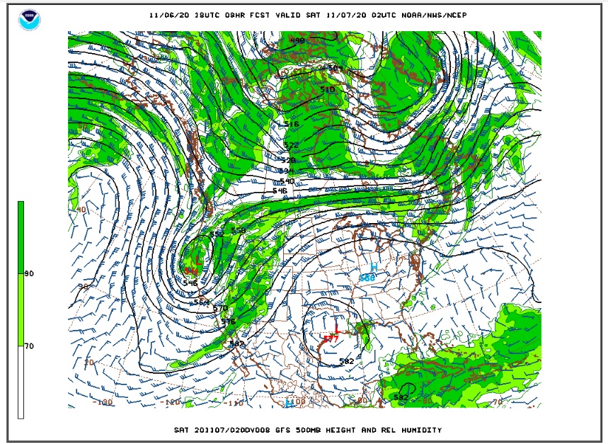
Our most recent stretch of mild and dry weather is about to come to an end, but not before we have one more day of relatively warm weather. High clouds were streaming over the Colorado Front Range Foothills Friday afternoon as a deep and cold storm system slowly digs into the West Coast. The Friday evening GFS upper air maps shows this upper level low spinning over northern California:
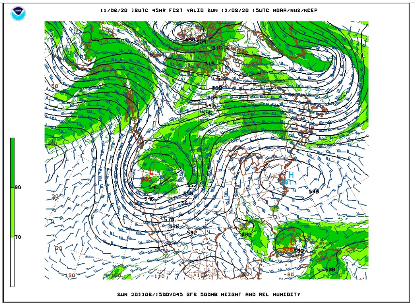
This storm system will slowly push east on Saturday, and it will be centered over the upper Great Basin on Sunday morning:
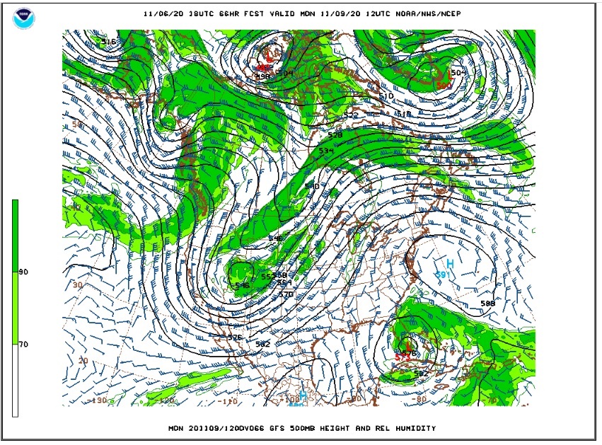
By Monday, this big spin in the atmosphere will split with a little piece of energy just to our west in Utah.
Although this is an impressive looking storm, the track and much of the energy will be focused to our north and west. This combined with the fact the the winds will generally blow from the west to northwest during much of this storm means that Nederland and communities to the east of the Continental Divide will get more wind than snow. However, it will get much colder with highs on Sunday only in the 30s F. By Monday daytime temperatures will struggle to reach the freezing mark, and it appears that this cold air will linger through the balance of next week.
Our best chance of accumulating snow appears to be on Monday when an inch or two could accumulate as snow showers blow over the Divide. Of course, locations west of the Peak to Peak Highway will see higher amounts with lighter amounts as you head down the Foothills towards Boulder and the plains.
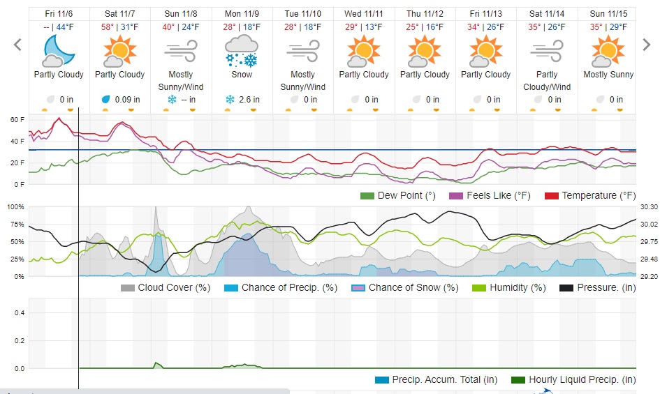
Here is the Weather Underground forecast for Nederland:
Saturday will be our last warm day for a while. Enjoy it!