The weather map over the next few days will be dominated by a large, warm area of high pressure centered over the southern plains and a deep storm system positioned off the northern California and Oregon coasts. Between these two systems, southwesterly winds will bring subtropical moisture and clouds into much of the Southern Rockies including Colorado. Higher dew points, clouds, and precipitation will help to keep daytime temperatures on the cool side with highs on Thursday and Friday in the Front Range Foothills communities generally in the low 70s F and lows near 50 F.
The 5 day quantitative precipitation forecast (QPF) from the weather prediction center clearly shows this stream of moisture over much of Colorado and the desert southwest:
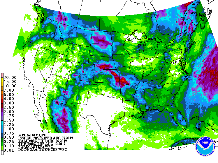
Notice how dry it is over central Texas directly under the area of high pressure. While this wind pattern is not optimal for Nederland to receive much rain (due to downsloping off of the higher Indian Peaks), scattered shows and thunderstorms will be possible through much of the weekend.
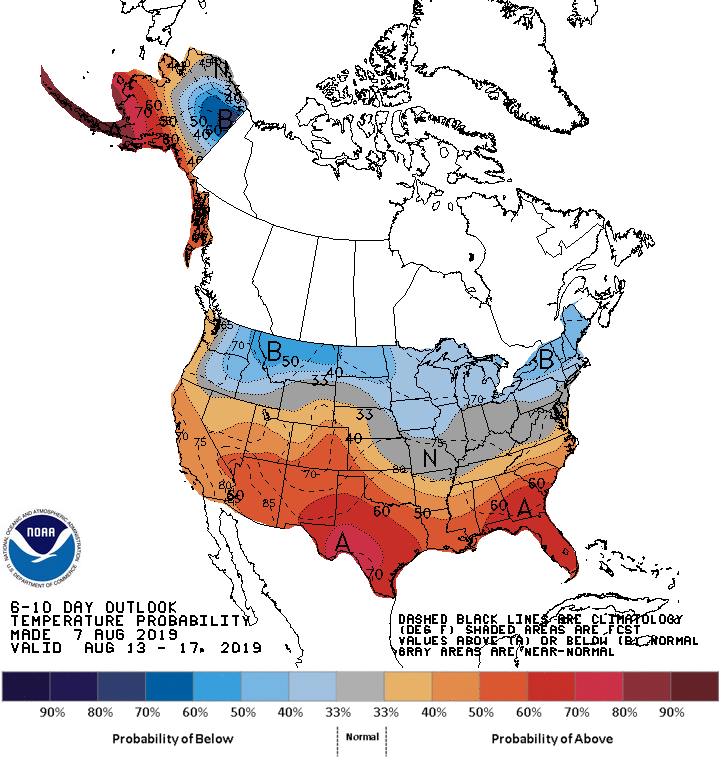
The 6-10 day outlook is heralding the return of drier and warmer weather next week. This is fairly common as the monsoonal rains tend to start abating by late August:

Enjoy the rain! Summer returns next week!
“Summer returns” Thank you Bryon!
Hi to Leslie.
lorena