Strong winds buffeted the Colorado Front Range Mountains and Foothills Tuesday Night and Wednesday. There were many reports of winds gusting up to 70-75 mph. Driven by these hurricane force winds, the Cameron Pass Fire raced 16 miles to the east towards Loveland and Fort Collins, putting those communities on alert. It is astounding to think of a fire traveling 16 miles in under a day, and it is a reminder of how rapidly a fire can grow given how dry we are. As I have mentioned in previous posts, this is only the beginning of the wind. It will be with us on and off into next spring. La Nina winters are windy, and unless we get some precipitation, fire danger will remain high.
Speaking of precipitation, the latest GFS total precipitation forecast shows almost no precipitation through the end of October for northeastern Colorado:
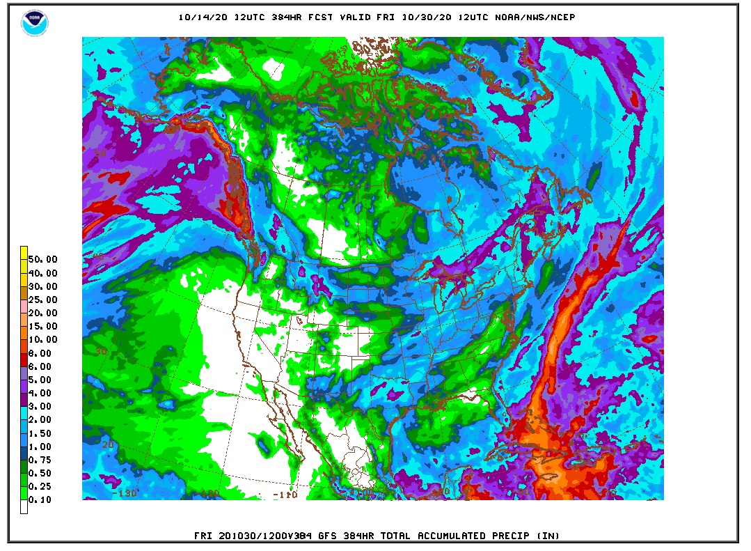
That is bad news for our drought and for the active fires in Northern Colorado. But we are getting used to being dry, right? It does appear that temperatures will be cooling off, perhaps to unseasonably cool levels. The latest 6 to 10 day forecast shows the colder air pouring into Colorado from the Northern Rockies and Northern Plains:
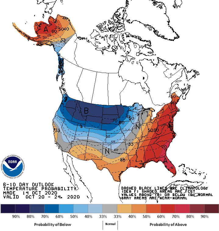
This may allow ski areas to start making snow since it does not appear that Mother Nature is going to be bringing any to us any time soon.
In the short term, a cold front will bring colder air to Nederland and the surrounding Foothills communities tonight and on Thursday. Thursday and Friday mornings will be chilly with lows in the low to mid 20s F. Highs on Thursday will struggle to get out of the 30s F but should reach into the 50s F by Friday. This colder air should give us a reprieve from the strong and gusty winds. You can see this on the NAM model sounding for midday Thursday:
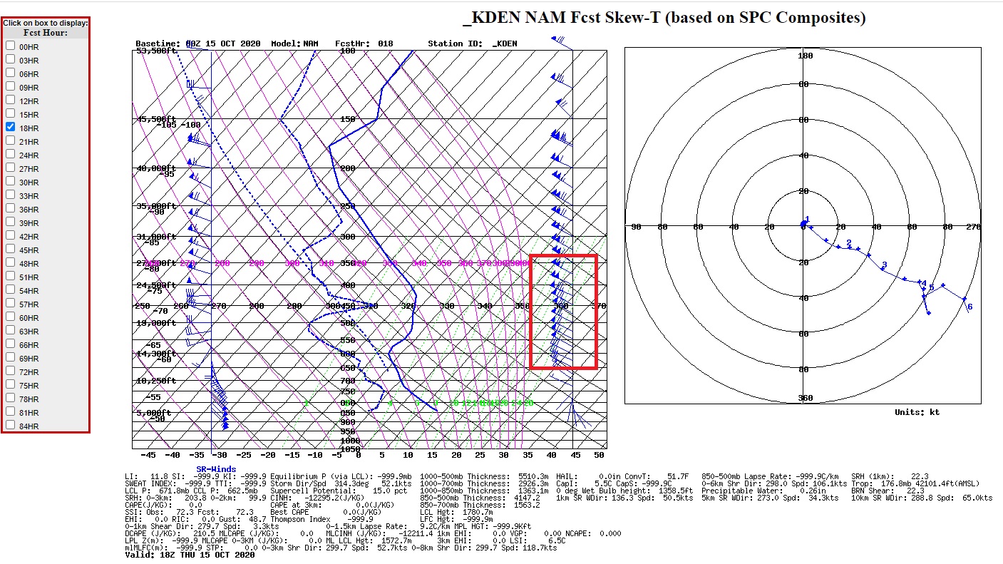
Notice that the stronger winds are much higher in the atmosphere above about 11000 feet. Some of this wind energy could mix down into the Foothills as the day progresses, but they will not be nearly as strong as they were on Wednesday.
Otherwise, things still look bleak on the latest Colorado drought monitor map:
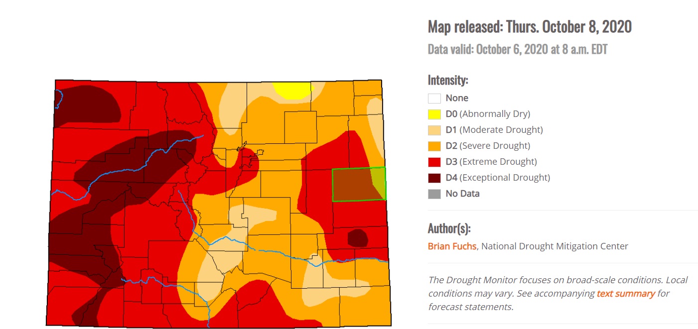
This puts most of Boulder County in the severe drought category. Not far to our west, however, parts of Grand County are experiencing exceptional drought.
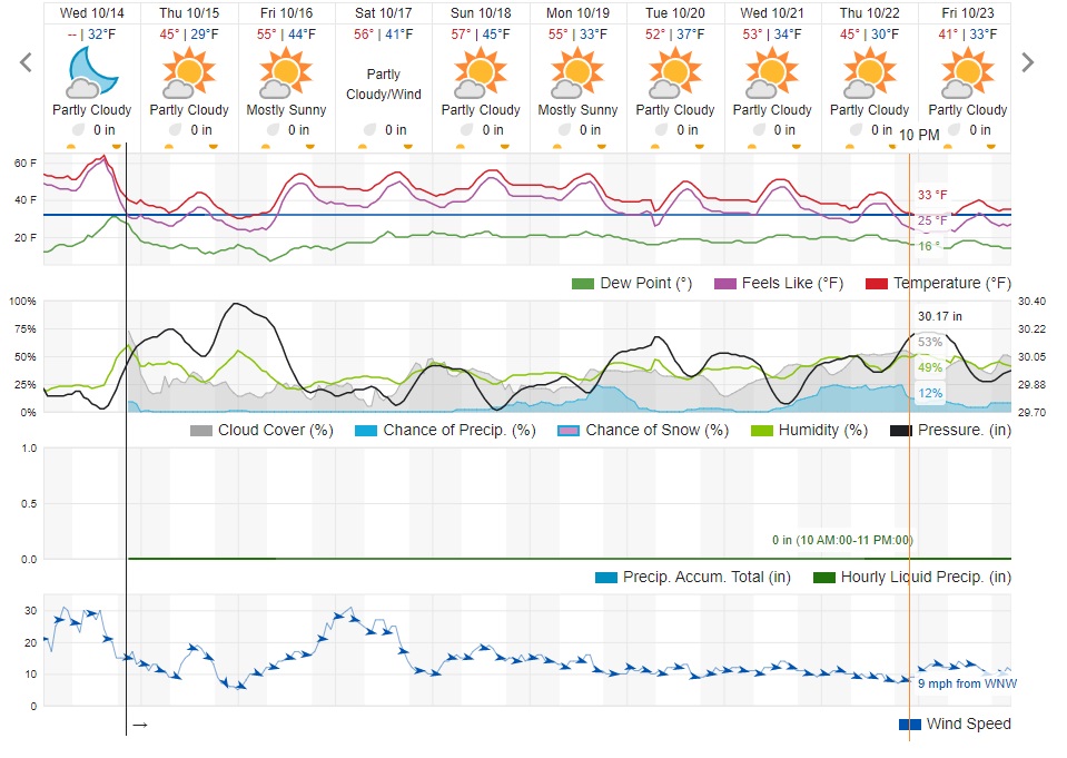
Here is the forecast from Weather Underground. Note that I think their low temperatures are bit too warm for us, especially tonight and Thursday night:
The weekend looks dry but windier. Go figure.