The forecast was spot on, and rain did fall in Nederland and the surrounding Foothills communities of northeastern Colorado starting Thursday afternoon. The precipitation continued on and off Thursday night, and it was not until late Friday afternoon that things dried out a bit. There was thunder and even a bit of pea-sized hail midday Friday. All told, we received 0.96 inches of rain here at our home 4 miles east of Nederland. Here is a map of the precipitation that fell into Friday morning. Most locations received more rainfall on Friday (the red star is Nederland):
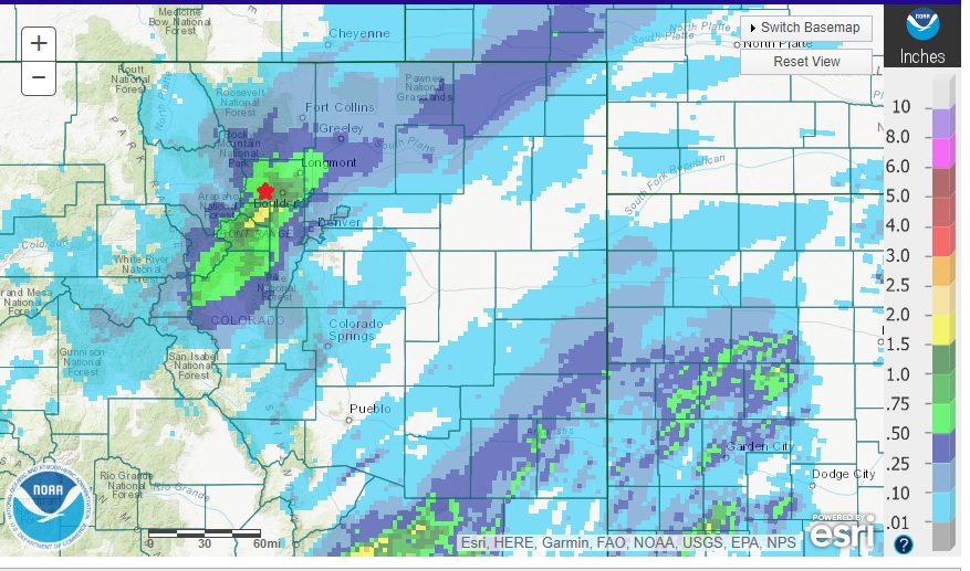
Notice the bullseye of precipitation just to our south in Gilpin County. This closely matches up to what the models were predicting. Also notice the southwest to northeast orientation of the pecpitation bands which nicely line up with the jet max that set up over us during this period.
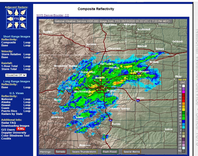
Here is a radar image from Thursday evening showing widespread precipitation over much of the northern Front Range Foothills:
And here is the corresponding satellite picture show the mid and high level clouds associated with this precipitation:
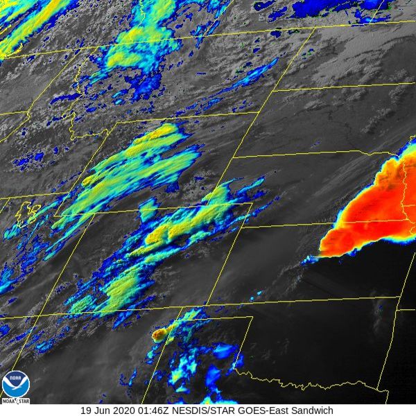
Again, notice the southwest to northeast orientation of the clouds as well as the high (more yellow and red) tops associated with deeper thunderstorms.
This was a two day storm for us. Here is how the precipitation totals broke down at our house:
Thursday, June 18, 2020: 0.46 inches
Friday, June 19, 2020: 0.50 inches
In the ten years we have lived here there have only been three other days in June with a rain total of 0.50 inches or more:
June 20, 2011 1.46 inches
June 17, 2018 0.85 inches
June 20, 2019 0.63 inches
Obviously, decent June rainfalls are relatively rare in what is otherwise a dry month.
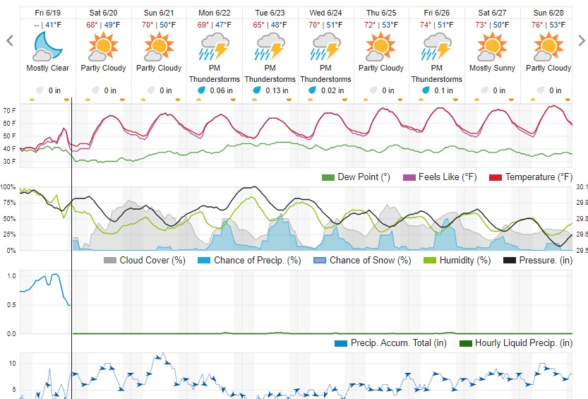
As of this writing, this weather system has exited to our east. Northwest flow and subsidence will dry us out on Saturday and Sunday. There will be high cloudiness mixing in with the sunshine, but overall it should be a super weekend with near normal temperatures! Here is the Weather Underground forecast: