The Autumnal Equinox will occur at 1:50 AM on Monday, September 23rd. Equinoxes are the only time of year where the number of hours of daylight and the number of hours of darkness are roughly the same amount of time – 12 hours – across the entire planet. The only exceptions are the North Pole, where the sun is setting and will remain absent for 6 months and the South Pole where the sun is rising. The Autumnal Equinox also marks the the beginning of fall in the Northern Hemisphere and spring in the Southern Hemisphere. Here in the Central Rockies, the longer nights mean cooler temperatures (see my last post) and many locations in the mountains and foothills have already seen their first frost and freeze.
We dropped to 32 F this morning here in Nederland, officially making this our first freeze of the season. We normally see the first freeze in the second or third week in September, so it was right on schedule. This was not a hard freeze (temperatures in the 20s F), but it is a reminder that colder weather and perhaps even snow are not that far off.
For lovers of lots of daylight and warm temperatures, the Autumnal Equinox is the proverbial nail in the coffin. Sure, we will still have a few warm days, even in October, but winter is coming. Meanwhile, skiers are counting down the days until the resorts start opening. From this point until March 20, 2020, the nights will be longer than the days.
After another chilly night with temps in the 36 – 41 F degree range, things will warm up a bit around here. On average, temperatures will be in the low 70s F on Monday and Tuesday with lows in the mid 40s F. A weak cold front will sag southward across Colorado on Wednesday, bringing slightly cooler temperatures, but overall it looks to be dry until Friday. On Friday, a stronger cold front will push across Colorado. Weak upslope flow behind this front may results in some rain showers over Nederland and the nearby Front Range Foothill Communities, with snow showers possible over 11500 feet.
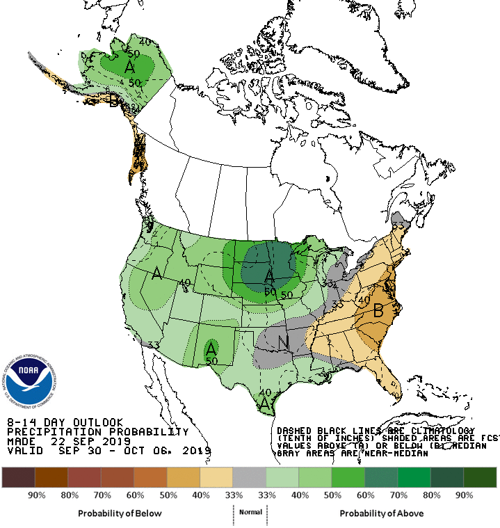
Looking further into the crystal ball, it looks like the weather pattern will become more unsettled in the 8 to 14 day period. The NWS 8-14 day outlooks (below) shows colder temps in the Western United States with above normal precipitation. If this holds, we could see our first flakes of snow in a week and a half. Higher elevations in the Indian Peaks may see accumulating snow.