But there may be a pattern change next week.
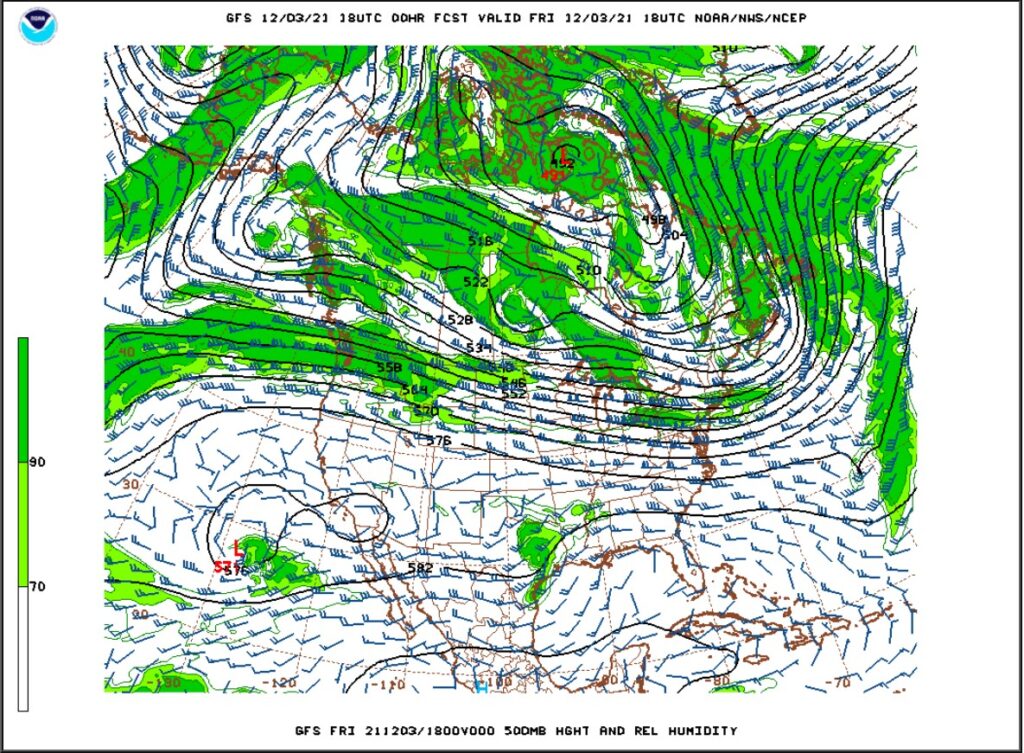
Much of the United States is experiencing above normal temperatures right now. This evening’s 500mb chart shows a zonal upper-level pattern across the country:

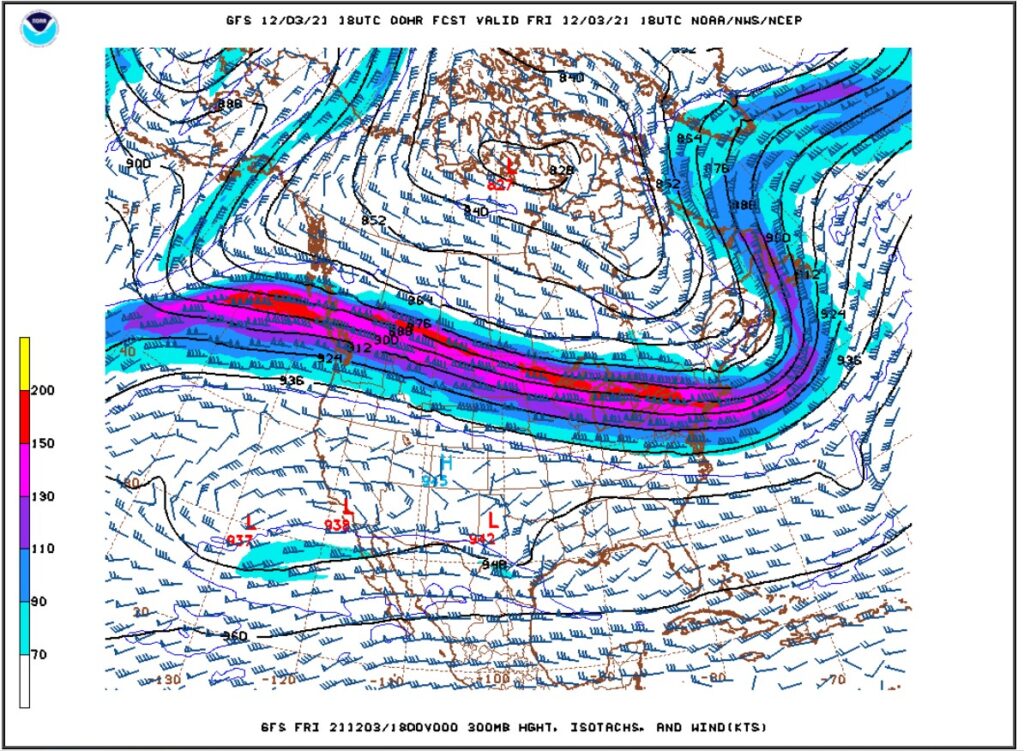
Normally in zonal patterns the jet stream is draped from west to east across the North American continent, trapping cold air to the north. Also, storms move very quickly, producing relatively little precipitation. The GFS 300 mb chart this evening shows a very strong jet stream draped across southern Canada with cold air over central and northern Canada and relatively warm and dry weather over much of the US:

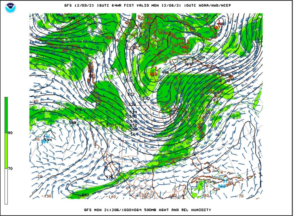
Saturday will feature another round of very warm and dry conditions. A ridge will begin to build off the West Coast on Sunday. In response to this ridging and teleconnections, the upper-level flow will become more amplified and less zonal with a trough digging into the upper Midwest:

This will place Colorado in northwest flow, and this should allow some Pacific moisture to blow into the northern mountains west of the Continental Divide. East of the Divide here in Nederland, it will be colder and much windier, which some blow-over snow showers possible in the Indian Peaks and Rocky Mountain National Park. A shortwave will bring a reinforcing shot of cold air and wind to Nederland on Tuesday. Temperatures will moderate briefly on Wednesday before a trough digs into the Western United States on Thursday and Friday. This is still nearly a week away, but models are hinting at a storm forming over the Southern Rockies, and this system could bring more substantial snow to portions of Colorado on Friday.
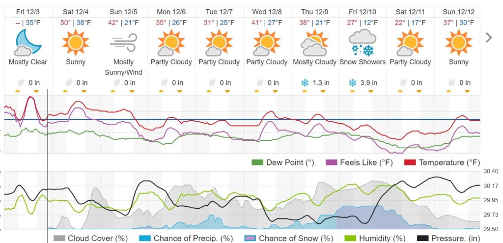
The Weather Underground forecast shows the cool down next week along with the possibility of some much needed precipitation:

In short, it will be turning colder and windier early next week – it will at least feel more like winter with normal temperatures for this time of year. The northern mountains should see accumulating snow, and Ned may see some of the white stuff later next week – we’ll see!