January is typically the driest month of the year in Nederland and the surrounding Front Range mountain communities. In many years, a warm ridge becomes anchored over the western United States forcing the storm track well to the north of Colorado and moderating temperatures. This results in predominantly dry conditions. It is not unusual for much colder air to surge into the eastern United States with precipitation in the form of rain, freezing rain, ice pellets, and snow affecting the major east coast cities. This type of pattern, also known as the positive phase of the Pacific North American (PNA) oscillation has been with us for many weeks now, and and it looks like it will be here to stay at least through the first few weeks of January.
This is not unusual for January. What is unusual is how relatively dry it has been so far this cold season in Colorado. This map showing the current Colorado snowpack as a percent of normal for this time of year says it all:
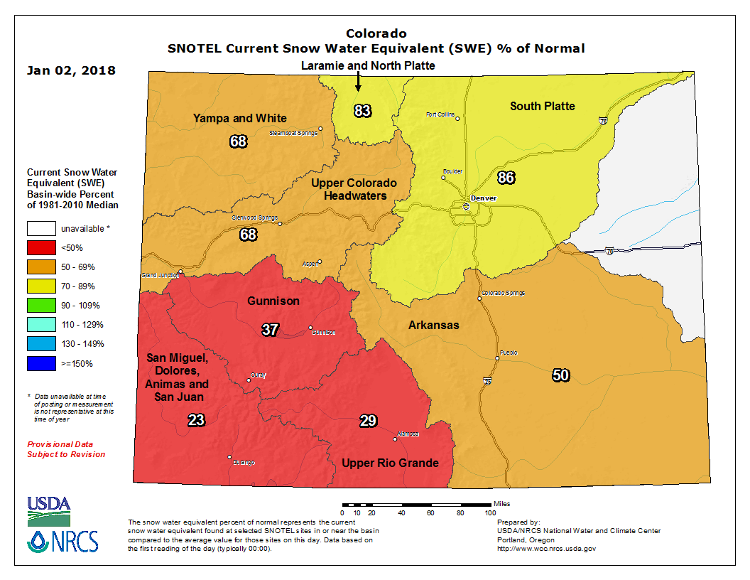
As you can see, the southwestern portion of the state has been very dry while the northeastern portion of the state, particularly in the South Platte river basin, is closer to normal. This is the river basin that Nederland and the Front Range foothills reside in. So far, based on my data, our community four miles east of Nederland has received 37.7 inches of snow which is about 5 inches less than our normal of 42 inches for this time of year. If you do the math, that is around 88 percent of normal which is not far off from the South Platte basin average of 86 percent.
For us in Nederland, our snowiest months are February, March, and April. We’ll see if this holds true this year. For now, look for a dry start to the new year.