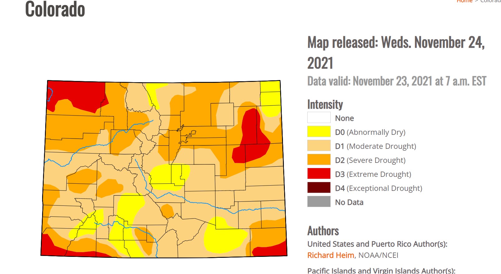
A large-scale atmospheric blocking pattern has brought predominantly warm and dry weather to the Colorado Front Range Foothills over the past few months. Colorado and much of the of the Southwest have quickly receded back into drought conditions with Nederland seeing borderline severe drought:
A very stubborn ridge of high pressure has anchored itself over the Great Basin forcing the Jet Stream and its associated storms and moisture well to our north. This northerly track has also prevented cold air from reaching the Central and Southern Rockies. The 500 mb height anomalies from the NOAA ENSO discussion show this persistent ridge:
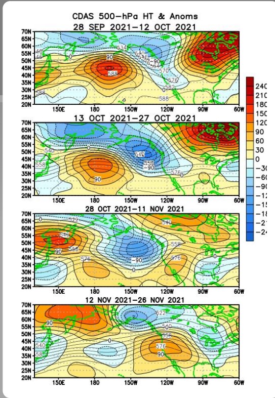
The unusually high heights are particularly evident from November 12 to 26th.
Of course, this is a La Nina year, and a more northerly storm track is one of the hallmarks of a moderate to strong La Nina. The excessive precipitation that parts of Oregon, Washington, and British Columbia have seen this fall are also effects of La Nina. Normally, in a La Nina winter, the hope is that the mountains in Northern Colorado can catch some moisture from storms tracking through the Central Rockies, but that has not happened this year, at least not yet. I hiked the Sourdough Trail near Ward, Colorado, this past Saturday, and the snow coverage between 9000 and 10000 feet on the east side of the Continental Divide is the worst that I have seen for late November in the 12 years we have lived in Nederland.
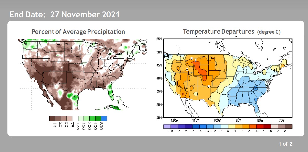
Check out this graphic from the Climate Prediction Center. It clearly shows how little precipitation and how warm we have been over the past 30 days. It also shows that with the exception of the Pacific Northwest, most of the rest of the country has been dry as well:
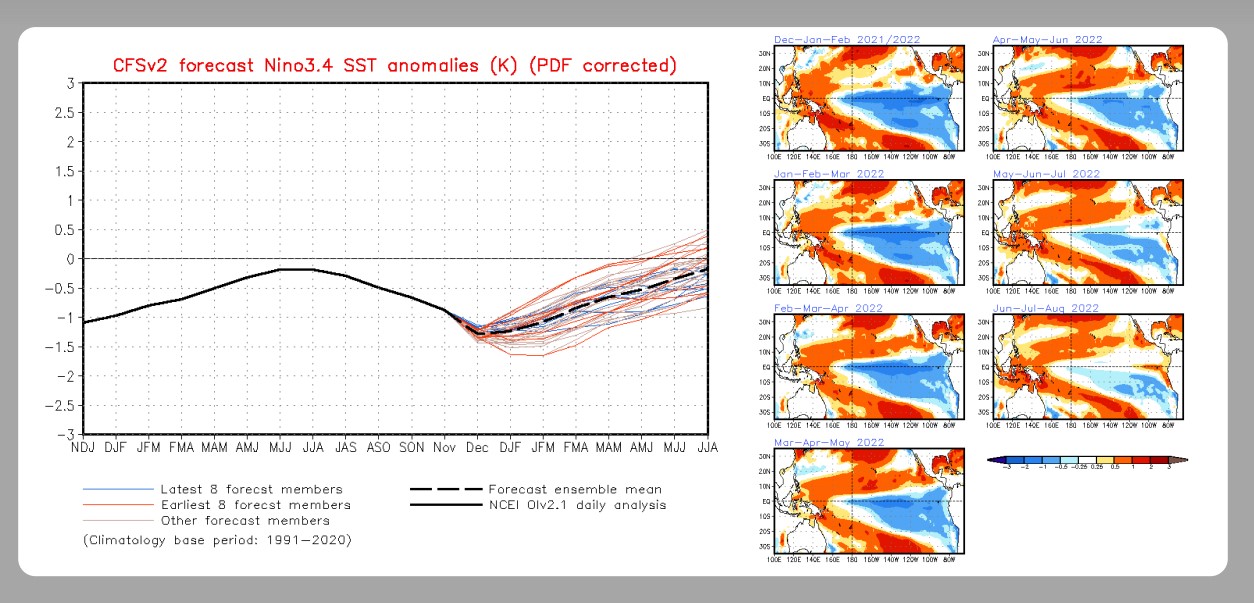
There are other teleconnections in addition to ENSO that can affect our weather, but ENSO does have a strong influence. The good news is that it appears that the La Nina is at its strongest right now, and the forecasts from NOAA are indicating that it should slowly be weakening over the next several months:
As the La Nina weakens this winter and early next spring, it could cause the western ridge to weaken and allow more storms and moisture to enter Colorado.
In the short term, the unseasonably dry and warm weather will continue through this weekend. Weather Underground’s forecast for Nederland is bleak if you are a snow lover:

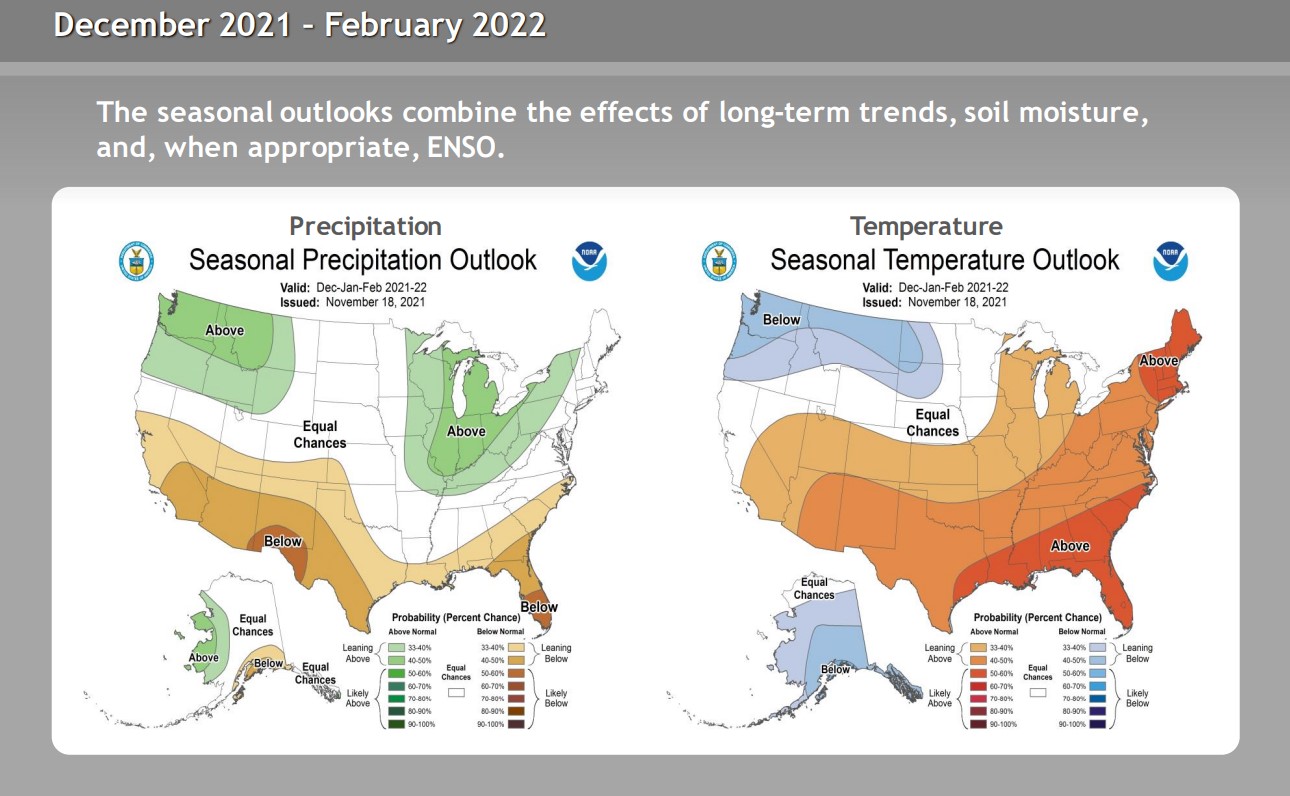
The NOAA outlook for December 2021 through February 2022 at least offers a glimmer of hope for some precipitation:
Do your snow dances or whatever ritual you can to bring winter back to our mountains!