After what seems like a few weeks of hot, dry, and sweltering weather in the Colorado Front Range Foothills cooler and moister air finally made its way into the Northeast Plains of Colorado today. Widespread showers and thunderstorms brought beneficial precipitation to many areas this evening, including 0.41 inches at our home just east of Nederland. Doppler radar estimated rainfall amounts show a bulls eye of +1 of rainfall amounts right over the town of Nederland (circled in red):
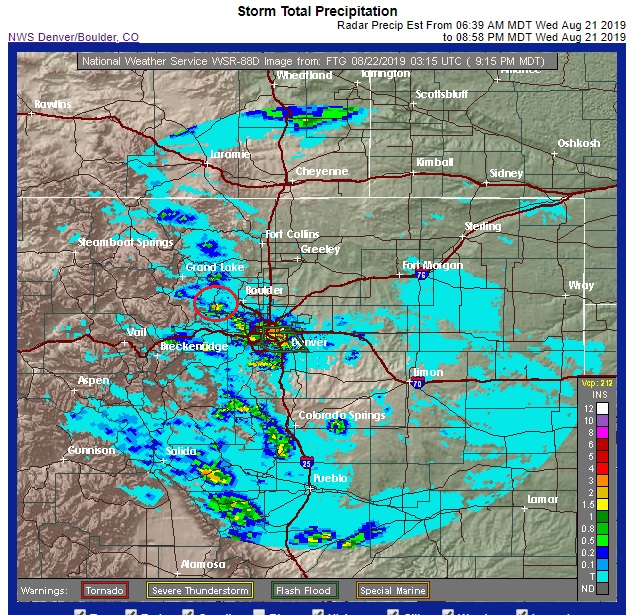
These estimates can be inflated by the existence of hail and ice in the storm clouds. It will be fun to check the CoCoRAHs observations tomorrow morning to see how much rain Nederland actually received.
Drier and warmer conditions will return to our area of the next few days. There will be enough residual moisture to fuel some isolated showers and thunderstorms on Thursday afternoon and evening. However, Friday, Saturday, and Sunday should be predominantly dry, sunny, and warm. Daytime temperatures will likely reach into the mid to upper 70s F in the Foothills communities.
By Monday, the next cold front will sweep into Northeastern Colorado and behind it temperatures should be more seasonable for much of next week.
This is the time of year when we start to get our first few teases of Fall weather – sunny warm days with cool crisp nights. This combined with the colorful fall foliage makes autumn one of my favorite times of the year.