The weather over the United States over the next several days will be dominated by two nearly stationary storm systems, one off of the coast of the Pacific Northwest and one over the Northeastern States. In between these storms systems over the Rockies and Great Plains fair weather high pressure will prevail. For Nederland and the adjacent Front Range Foothill communities, the streak of dry and unseasonably mild weather will continue through the weekend and into early next week.
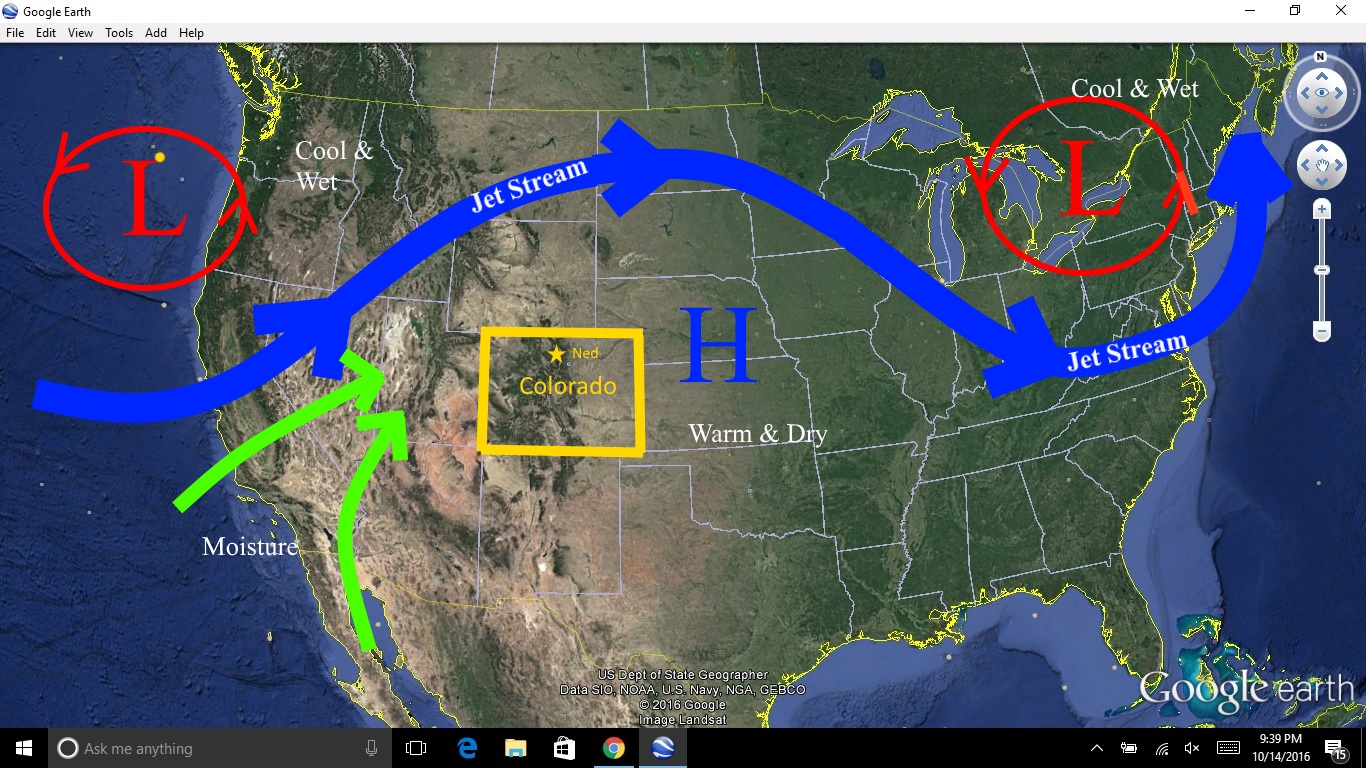
Slow moving or nearly stationary storm systems often constitute what is known as a blocking pattern in the atmosphere. Near the storms, wet and cool weather can persist for days. Between the storms, high pressure dominates and tranquil weather is the rule. Blocking patterns can be durable and hard to change. It can be difficult to forecast exactly when a block will break, and computer weather models are particularly challenged by them. In our case, the jet stream, a narrow ribbon of winds which steers storms and is often labeled as the storm track, will remain well to our north over the next several days, leaving us high and dry. If you like fun in the sun, you are in luck. If you are waiting for snow and skiing, hang in there. There is still some indications that a stormier pattern will set in in early November. Later this weekend, and early next week some Pacific and Gulf of California moisture will make it into the Great Basin and western Colorado. This will result in showers, mainly west of Nederland and the Continental Divide. However, snow levels will be high and rain will fall even over the ski resorts in the central mountains of Colorado.
This is a great explanation of the “block” we are in — thanks for your great interpretation!