Despite the fact that the sun was obscured by high, thin clouds for much of the day here in Nederland, Colorado, the temperature soared to near 61 F by early in the afternoon. Despite the warmth, this week will showcase some wily weather, which is typical of spring here in the Central Rockies.
The weather roller coaster begins on Tuesday when a cold front sags southward across Northern Colorado during the afternoon. This front combined with a deepening low pressure system over the Colorado Eastern Plains will result in strong and gusty Bora winds in the Front Range Foothills communities. Temperatures will quickly drop back into the 30s F in the afternoon. However, the west northwesterly winds will keep most of the precipitation on the west side of the Continental Divide. Aside from a passing snow shower or two, Nederland, Ward, and Blackhawk should remain dry. Cold air will settle across the Northern Front Range Tuesday night and temperatures will drop into the low 20s F in most places by Wednesday morning.
An upper level storm system will dig into northern California Wednesday night and slowly form a deep cut off low over southern Nevada by midday Thursday. Ahead of this storm, temperatures will moderate over Colorado and the Central Rockies as southerly winds bring in warmer and moister air. Temperatures on Thursday will once again soar into the 50s F in the Foothills and closer to 70 F on the nearby Plains.
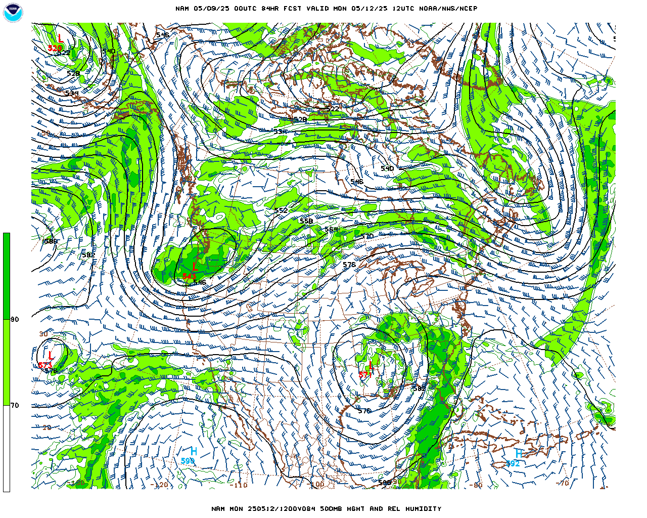
Where this upper level low tracks on Thursday and Friday will greatly determine the weather here in Nederland. If this low tracks along the Colorado/New Mexico border, then very deep and moist upslope flow will develop over much of Colorado, focusing precipitation on the Eastern Plains and the eastern slopes of the Front Range foothills and mountains. Although precipitation will initially start as rain on Friday in most areas, snow levels will steadily drop during the day and heavy snow is possible Friday afternoon and Friday night particularly above 6500 – 7000 feet.
Many of the ingredients for a significant precipitation event are there – and we need this precipitation. Below is the 84hr forecast for the NAM model of the position of the upper low. It looks good now. We’ll see how it all comes together over the next few days.