The Northern Mountains of Colorado including the Front Range will be receiving copious amounts of snowfall over the next 48 hours. A moisture laden northwesterly wind flow in the mid-levels of the atmosphere will bring precipitation into Northern Colorado. This will highly favor the westward facing slopes of the Northern Mountains including the Park Range and the Indian Peaks. However, during the day on Wednesday, a strong cold front will push southward into the state. Behind this front, upslope winds will help produce snow in Nederland and the surrounding Front Range Foothills communities. During Wednesday afternoon and evening a jet streak will approach us. It looks like we will be in the right rear exit region of this jet which should help to enhance lift and precipitation over us:
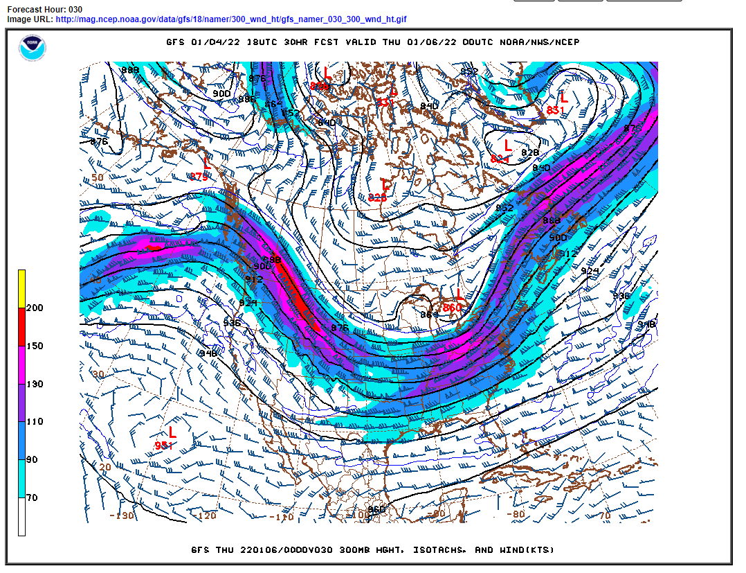
Overall, there is not an impressive surface storm or a large amount of upper-level energy associated with this system. It is really the dynamics associated with this jet streak that are expected to produce measurable snowfall here in Ned. It looks like the best period for accumulating snow will be Wednesday afternoon and Wednesday night. Once the cold front pushes through, the winds should die down considerably. It has been snowing most of the afternoon here, but the winds have made it difficult to measure.
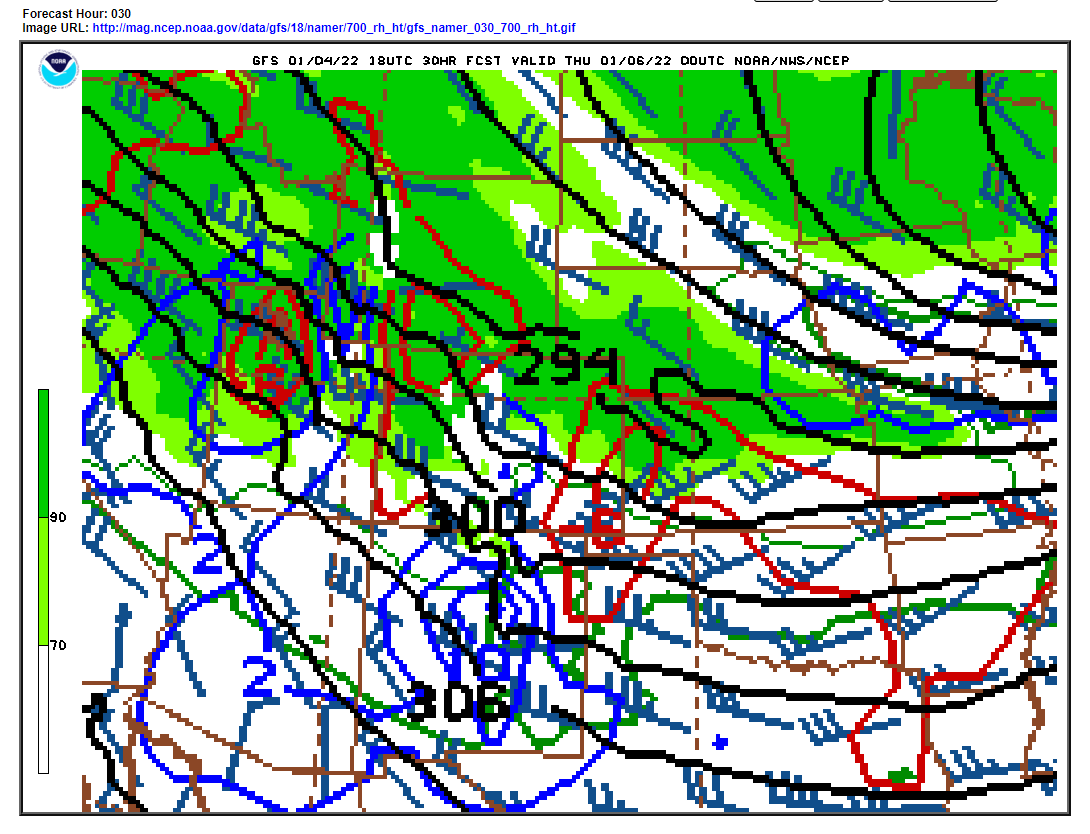
It is hard to even find decent QG ascent at any time during this storm. This leads me to think that perhaps the models are picking up on conditional symmetric instability (CSI) or banding. A quick look at the 700mb map shows little if any vertical ascent (omegas) over us:
Accumulations with this system will be tricky to nail down particularly east of the Divide especially if the precipitation is banded.
The latest NAM is producing about 0.50 to 0.75 inches of liquid for us while the GFS is close to 1 inch. This would translate to a snowfall forecast of 7 to 15 inches. The NWS weather service is call for 7 to 11 inches, while Weather Underground is forecasting 9 inches. The Weather Prediction Center’s 50th forecast is for around 10 to 12 inches:

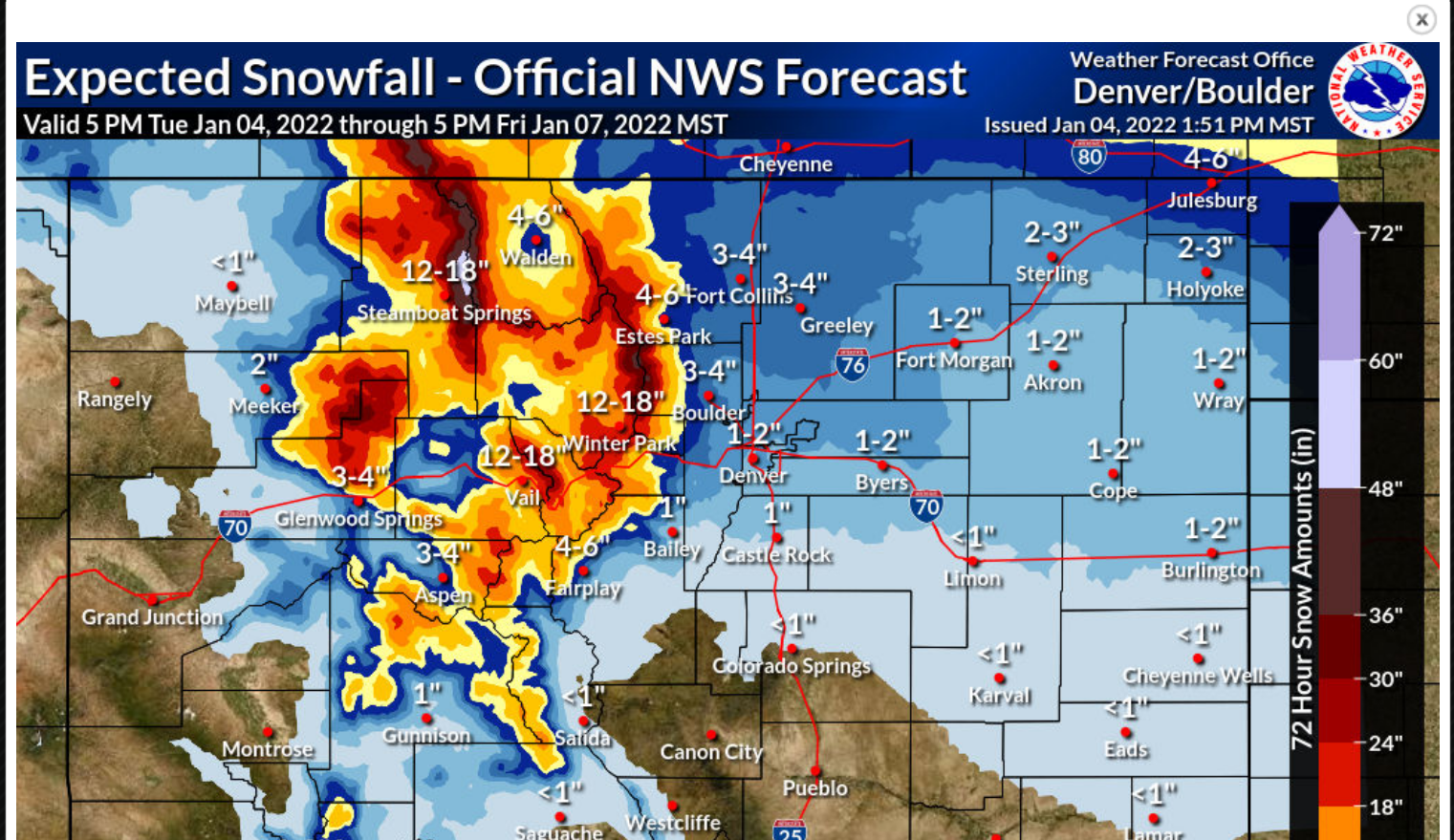
The National Weather Service’s most probably snowfall forecast is for 6 to 12 inches in the higher Foothills with more than 2 feet in the Indian Peaks:
With a consensus forecast of 7 to 10 inches of snow, it is important to note that climatologically speaking, we do not normally see large snowfalls in January. Our largest January snowfall is 18.1 inches on January 4-5, 2017. The rest of the January snowfalls in my records are 9.5 inches or less. Interestingly enough, Dark Sky is not calling for much if any snow for Nederland. Huh? I’m not sure how Dark Sky derives their forecast, but apparently it is not giving much credence to the model data.
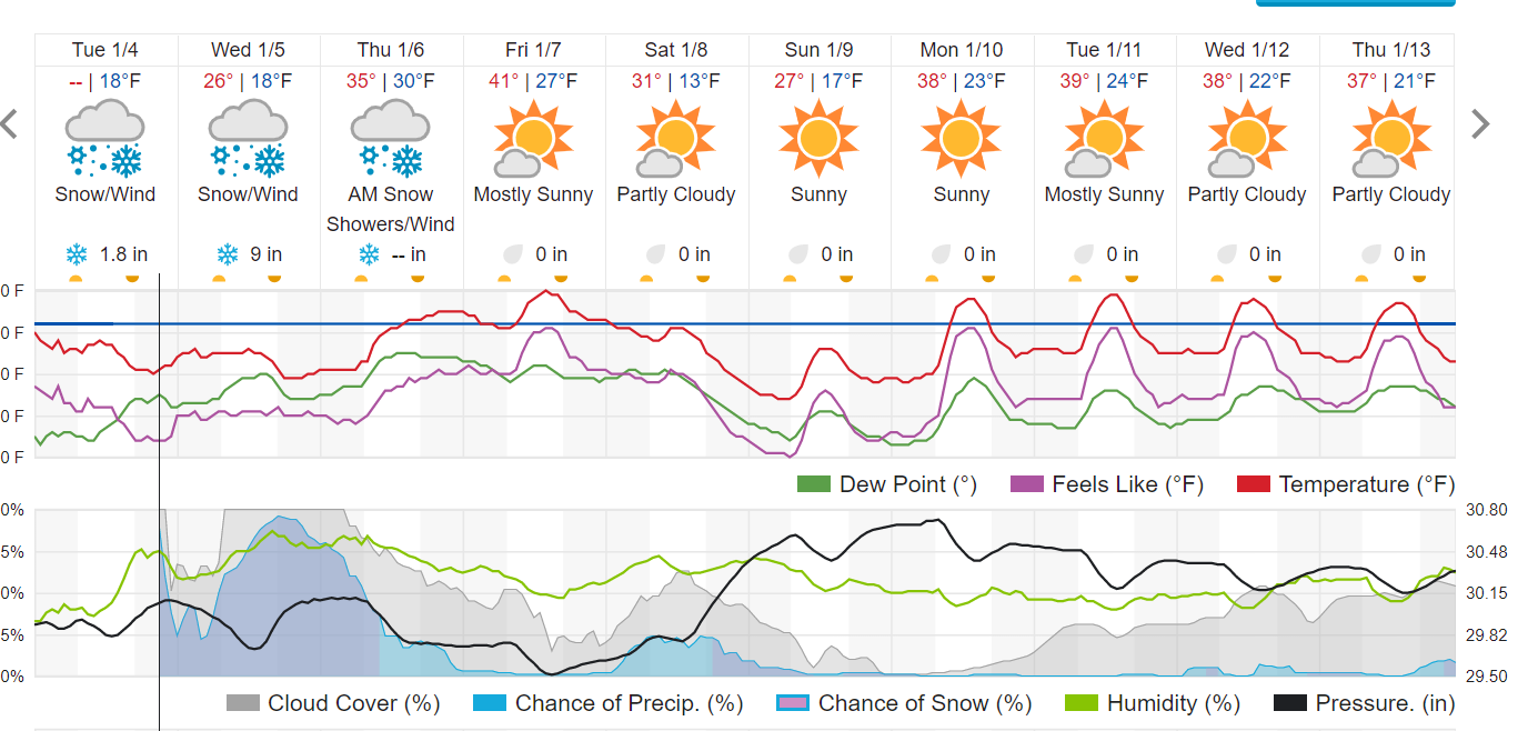
Here is the latest forecast from Weather Underground:
It is important to remember that there will be a sharp gradient is snowfall accumulations from the Plains to the Continental Divide. Boulder is only expected to see 3-4 inches of snow.
For those heading into the backcountry after this storm, avalanche danger will likely be considerable. Keep informed of the latest Colorado Avalanche Information Center information.
In short, this is a tricky forecast. Heavy snow amounts of up to 2 feet will fall in the Indian Peaks making for some incredible skiing in and around Brainard Lake. It does look like snow will fall in the Foothills as well. Amounts will be highest along and west of the Peak-to-Peak Highway. Right now, based on the data I have, it looks like 6-10 inches is a reasonable forecast for Nederland.