Cold weather has returned to the Colorado Front Range, and we actually have measurable snow on the ground. It is only around one inch, but it is enough to cover the bare brown ground and make it feel like winter.
Temperatures have been averaging below normal for the past several days:
| Day | High | Low | Precipitation | Snow |
| Saturday, December 25 | 35 | 20 | 0.01 | 0.1 |
| Sunday, December 26 | 33 | 16 | 0.04 | 0.5 |
| Monday, December 27 | 29 | 16 | 0.06 | 0.6 |
| Tuesday, December 28 | 26 | 7 | T | T |
| Wednesday, December 29 | 27 | 10 | T | T |
We have one more day of dry conditions before there is a drastic change in the weather pattern. I mentioned in my last post that there would be a chance of snow on Friday as a trough approaches us from the West Coast. At that time, it appeared that the mountains would get the brunt of the snowfall with much lighter accumulations east of the Continental Divide and on the Eastern Plains. Over the past few days, the models have been trending stronger with this upper-level storm and stronger with a cold front that will be plunging southward across Northern Colorado on Friday.
The GFS 500mb chart for midday Thursday shows two pieces of energy, one off the southern California coast and one entering the Pacific Northwest.
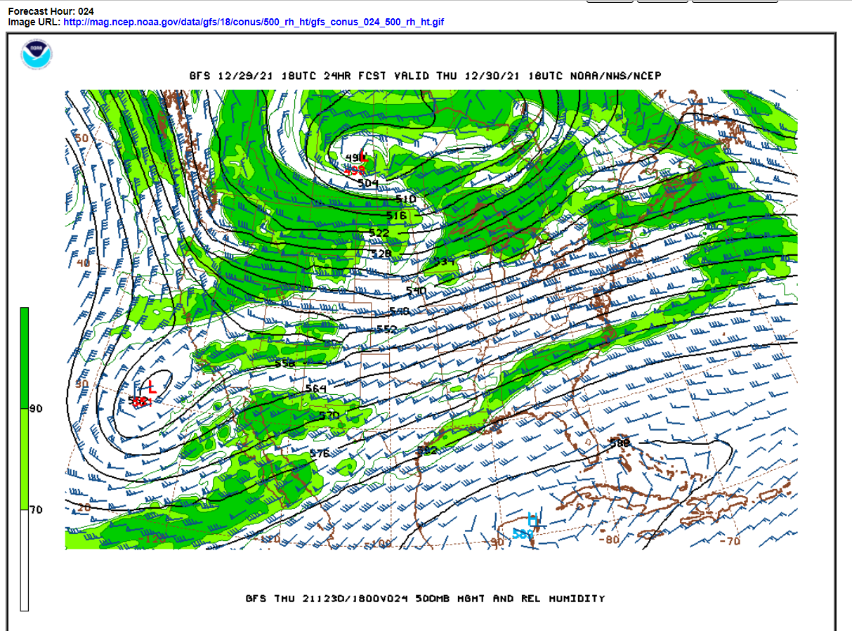
It is the interaction of these two pieces of energy that will determine the ultimate track of this storm across us and the amount of snow we see east of the Divide. By Friday, these pieces of energy will merge into an open trough which is expected to sweep across Colorado Friday night:
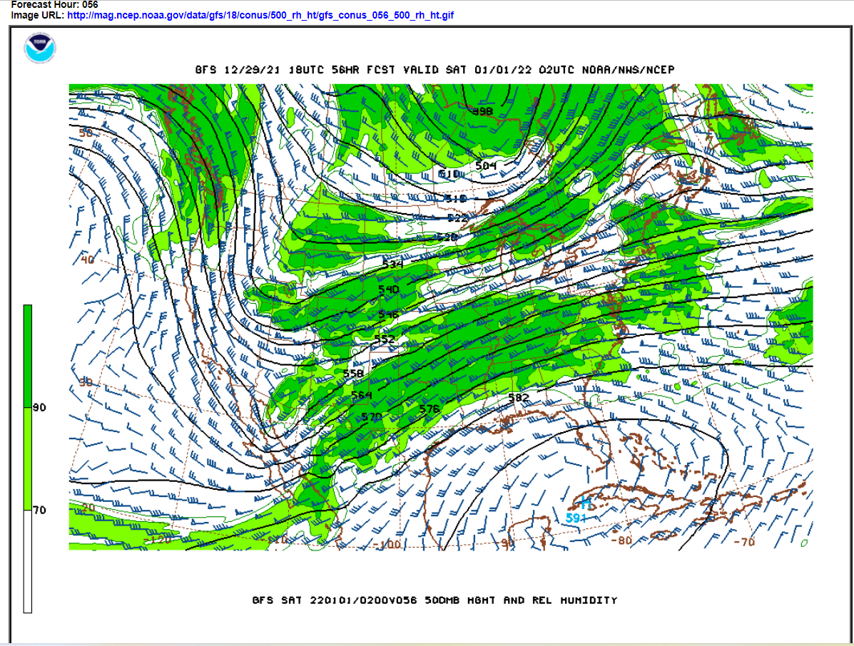
Note that this is a progressive storm. It never closes off. It is really the combination of moderate upper-level lift ahead of this trough, upslope flow behind a very strong cold front sweeping across Colorado, and a moist southwesterly flow aloft that will produce a period of snow for Nederland and the surrounding Foothills communities.
The latest NAM and GFS are both putting out between 0.50 inches and 0.75 inches of liquid for Nederland Friday into early Saturday morning. Mid-level temperatures in the atmosphere look like they will support good dendrite (snowflake) growth. Given this, it is reasonable to expect a 1:15 snow ratio and accumulations of 7 to 11 inches.
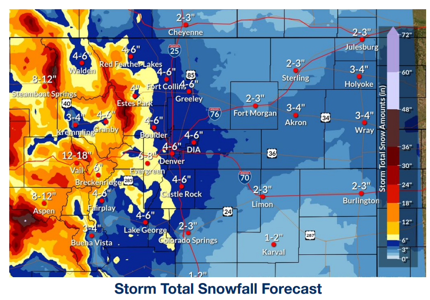
Right now, the NWS is calling for 6 to 8 inches for Nederland with higher amounts along and west of the Continental Divide – up to 2 feet in the higher elevations of the Indian Peaks Wilderness:
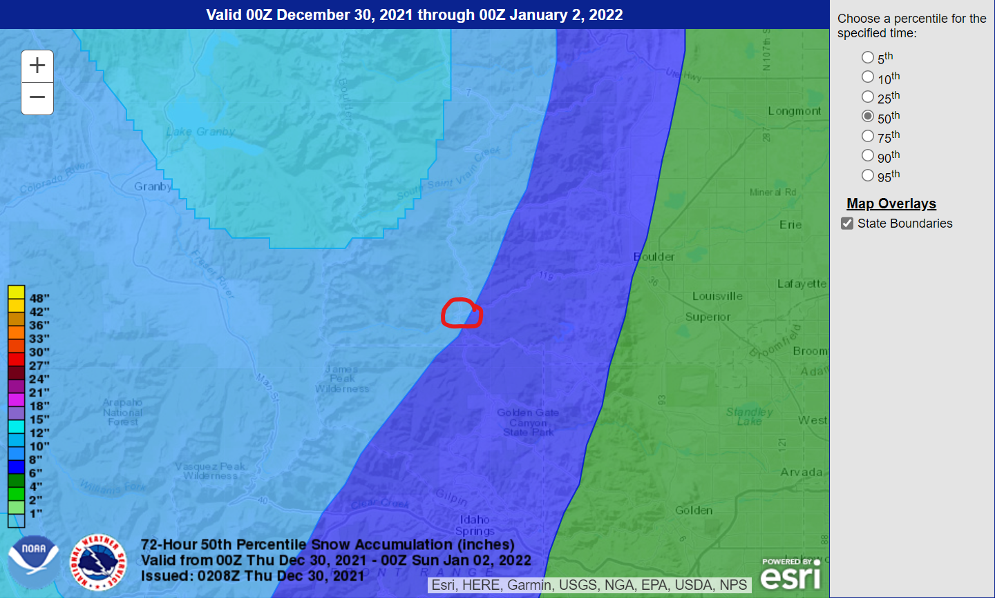
The Weather Prediction Center’s 50th percentile snowfall forecast has Nederland (red circle) on the cusp of the 6-8 and 8-10 inch amount ranges:
DarkSky is calling for 8 inches and WeatherUnderground is showing 7 inches.
A lot can still change with this storm, but it is our first shot at a decent snowfall this season. Here is the WeatherUnderground forecast:

In addition to the snow, it will be very cold, particularly on Saturday with a high temperature only around 10 F!
Note that Nederland is under a High Wind Warning from 5 AM Thursday through 11 PM Thursday night. Winds of 25-40 mph are expected with gusts to 75 possible. The saying, “the calm before the storm”, does not always apply in Colorado… Often the winds blow the strongest before the storm arrives.