It has been a warm start to June, but cooler weather is on its way for next week. Here are my temperatures for the past several days:
Sunday, May 31 – High 77 F Low 45 F Precip: 0.04 in
Monday, June 1 – High 80 F Low 54 F Precip: 0
Tuesday, June 2 – High 76 F Low 50 F Precip: 0
Wednesday, June 3 – High 77 F Low 49 F Precip: 0
Thursday, June 4 – High 75 F Low 49 F Precip: 0.02 in
Friday, June 5 – High 81 F Low 49 F Precip: T
We’ve already had two days with highs at or above 80 F.
A deep, cold (for this time of year) trough digging into the Pacific Northwest Friday evening will influence our weather through the weekend and into the middle of next week. Ahead of this trough, Saturday will be very windy with a decent chance of thunderstorms during the afternoon. Here is the Skew-T analysis for 12 PM Saturday:
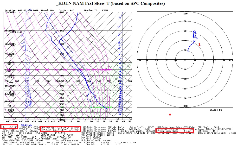
On the hodograph, at about our elevation (labeled “1” on the diagram) winds are shown at a sustained 35-40 mph with gusts up to 50 mph possible. There is also some instability (a lifted index of -2.1) and a precipitable water value of 1.15 inches. Normally with strong winds we would get downsloped off of the Continental Divide, but the storm motion vector is projected to be from the SSW at about 45 mph. We can get some decent thunderstorms on a SSW mean wind. These storms will be moving so quickly, however, that any moderate bursts of rain will not last very long.
A bigger concern are the winds, particularly after our round of thunderstorms on Friday which produced lightning but very little rain. There is a report of a lightning induced fire somewhere off of Sugar Loaf Road this evening. Tomorrow’s winds could quickly cause any smoldering fires to flare up. June in the Colorado Front Range is never a fun time of year when it comes fire concerns. Grasses are still relatively green around here, and humidities will be higher on Saturday, and this will help to mitigate the fire dange somewhat.
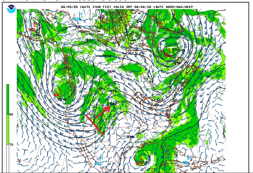
The chance of rain will be augmented on Saturday afternoon by a piece of energy rotating around the main West Coast trough. As this piece of engery tracks northeastward across the Southern Rockies during the afternoon hours precipitation should become more widespread:
Sunday should see a break in the weather action. It will not be quite as hot with highs in the upper 60s F, but widespread subsidence in the atmosphere should keep the sky mostly clear with little chance of precipitation. It will still be breezy, though with winds 15-20 mph with gusts up to 30 mph.
A strong cold front will push into northeastern Colorado early Monday morning, and high temperatures on Monday will struggle to reach 50 F! A push of moisture on Monday evening will likely produce a quick round of showers which could mix with some snow around Nederland. By Tuesday morning, the models are hinting at low temperatures right around 32 F perhaps even colder in some of the more sheltered locations in Foothills.
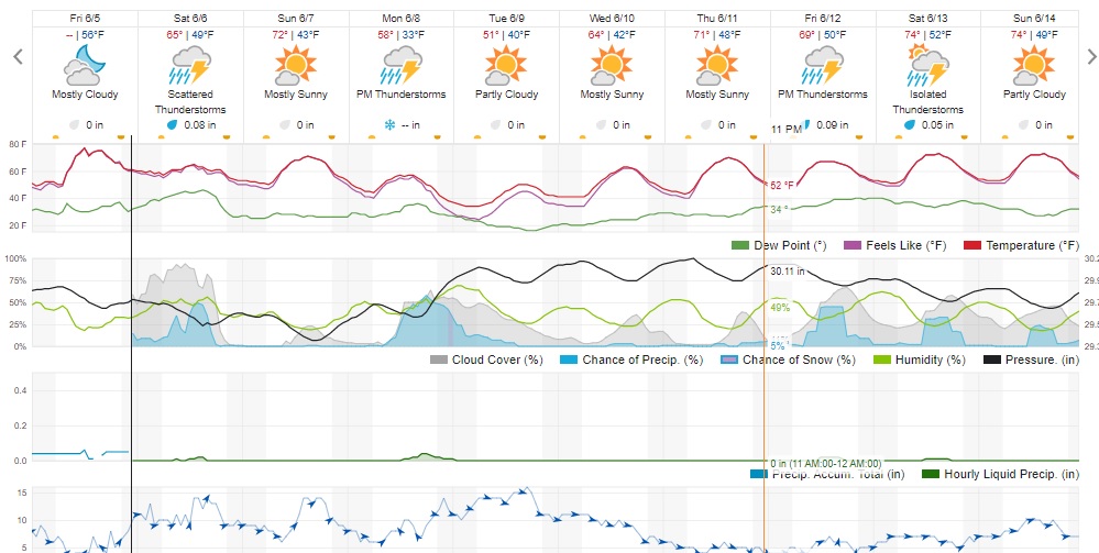
Here is the Weather Underground forecast:
Enjoy the start of the weekend!