And it depended on where you live in Ned. Our home is on a forested north-facing ridge, and snowfall on December 24th and 25th totaled a whooping (I’m being slight facetious here) 0.6 inches. We had 0.5 inches of snow on the ground on Christmas Day with another 0.1 inches falling in the morning. This meets both criteria of a white Christmas – measurable snow on the ground and measurable new snowfall. It has been a bad winter so far if we are getting excited over 0.5 inches of snow.
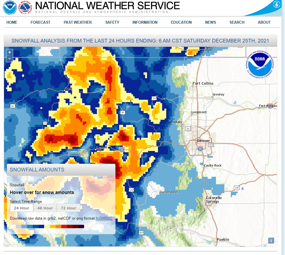
We spent Christmas Eve skiing at Winter Park where the recent storm delivered nearly 15 inches of new snow. Areas along and to the west of the Continental Divide did well with snowfall. In the Indian Peaks Wilderness near Brainard lake, the SnoTELs are reporting almost 12 inches of new snow since December 23rd with slightly higher amounts northward towards Rocky Mountain National Park. The latest snowfall analysis from the National Weather Service tells this story well:
Looking at my observations, Nederland and the surrounding Front Range Foothills communities have been extremely warm this December. Our average temperature for December has historically been 26 F (with an average high of 35 F and a low of 17 F). This December, our average temperature has been 32.9 F, almost 7 F above normal! This is a significant departure from climatology and is a tribute to a persistent storm track that has trapped moisture and cold air well to our north.
This is now officially the least snowy season so far in my records which go back to 2010:
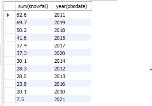
As you can see, the winter of 2021-2022 is dead last so far.
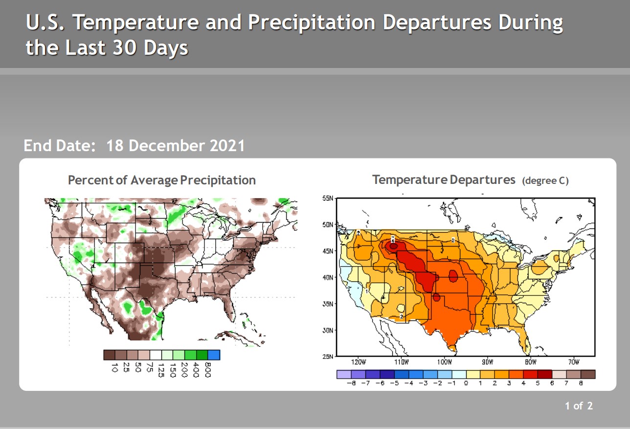
Data from the Climate Prediction Center tells a story of few cold air intrusions in the Contiguous United States and large swaths of below normal precipitation over the past 30 days:
And the drought monitor is abysmal, particularly for the West:
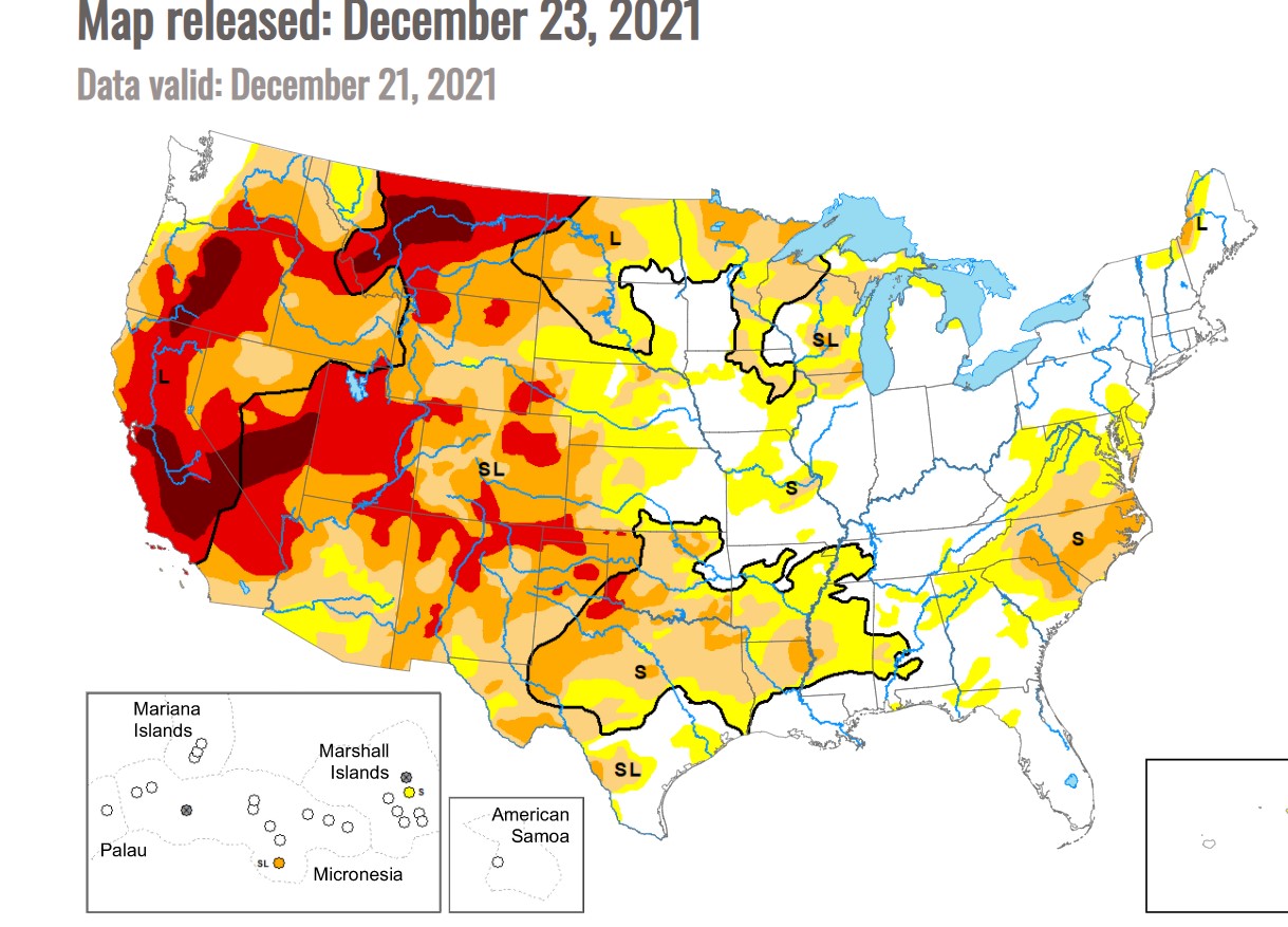
Western Boulder County is in severe drought with a large swath of northeastern Colorado in extreme drought.
January is typically the driest month of the year for Nederland with only 0.75 inches of liquid or 13 inches of snow on average. In the 12 Januarys we have lived here, we have only had one snowstorm over 10 inches (18.1 inches on January 4-5, 2017). Most January snowfalls have been less than 9 inches. I am not optimistic that we will make up much of our precipitation deficit in January 2022.
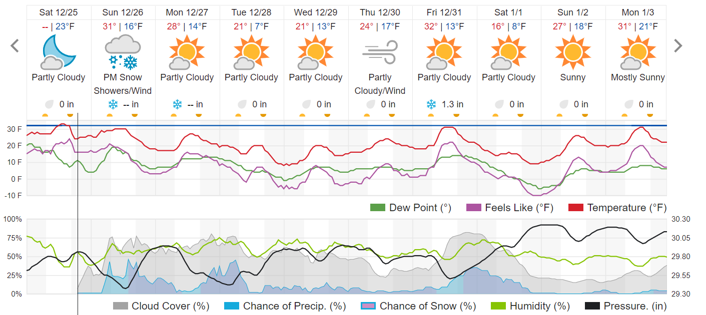
Over the next 5 days, a deep, cold trough will be camped out over the West Coast producing copious amounts of precipitation in Washington, Oregon, and California. Colorado will be in the west/southwesterly wind flow ahead of this trough. The first in a series of moisture laden pieces of atmospheric energy will push across the state on Sunday with another on Tuesday and yet one more later in the week. This will bring more snow to locations along and west of the Continental Divide. Here in Ned, we may see a few periods of light snow, but the bigger story will be the colder temperatures. Weather Underground shows subfreezing temperature through much of next week:
Interestingly, the Pacific North America teleconnection has been negative for some time and is expected to remain negative into the new year:
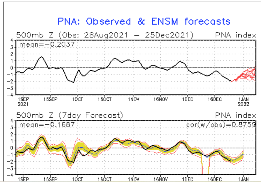
This corresponds to storminess in the western US and milder weather in the East. We’ve been seeing that storminess in portions of the West, but the Front Range in Colorado has missed out on most of it.
In short, the upcoming week will feature cold and wind. Several inches of new snow will be possible Sunday, Tuesday, and Friday along and west of the Continental Divide with lighter amounts possible in Nederland. Temperatures will be below normal to start the week off. It will feel like winter even though there isn’t much snow here.