As of this writing colder air is already filtering into Northeastern Colorado and the Front Range Mountains and Foothills. Not much has changed in the forecast. Snow is still expected to develop in Nederland and the surrounding Foothills communities after midnight and continue into Wednesday morning. Temperatures will fall back into the 20s F tonight and stay there on Tuesday before dropping back into the 15-20F Tuesday night. We are still looking at 12-18 inches of snowfall by the time the storm exits the region on Wednesday, with a few locations seeing up to 24 inches.
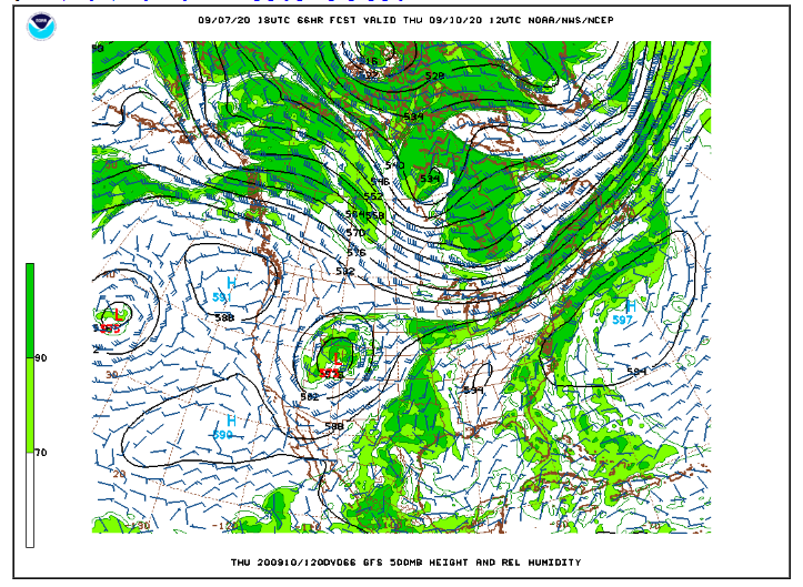
What is remarkable about this storm is how deep and slow moving it will be. Looking at this evening’s 500 mb map, you can see the energy associated with this storm carving out a trough over the Great Basin:
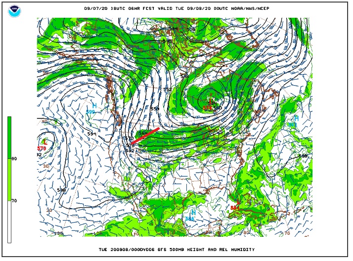
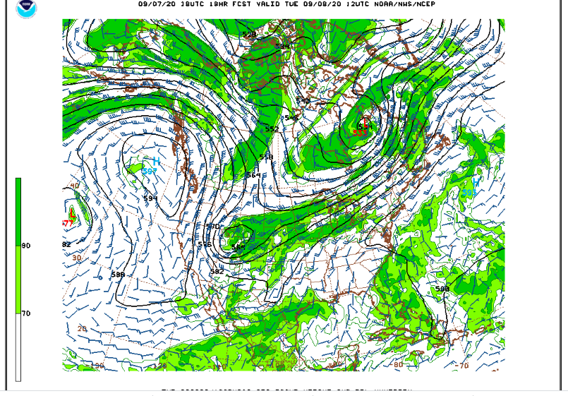
By Tuesday morning, this storm is cutting off into a deep low in northeastern Utah:
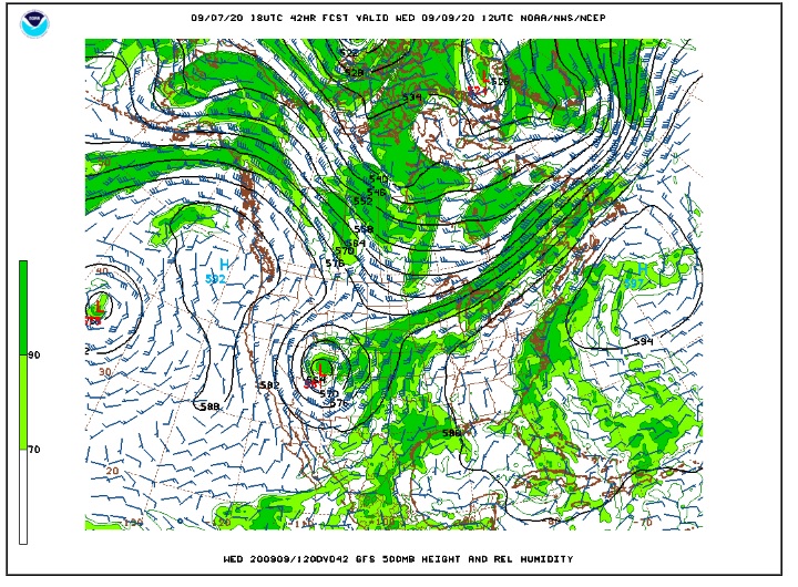
By Tuesday evening, this storm is near the Four Corners region:
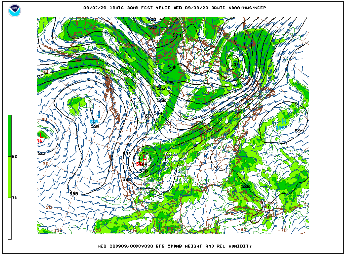
By Wednesday morning, this storm is still near the Four Corners Region:
It is not until Thursday Morning that the storm begins to weaken and lift out of here:
Even though this storm is a slow mover, it will not be snowing the entire time it spins to our west. The heaviest and steadiest snowfall will likely be on Tuesday and Tueday evening. After that, periods of light snow will continue into Wednesday.
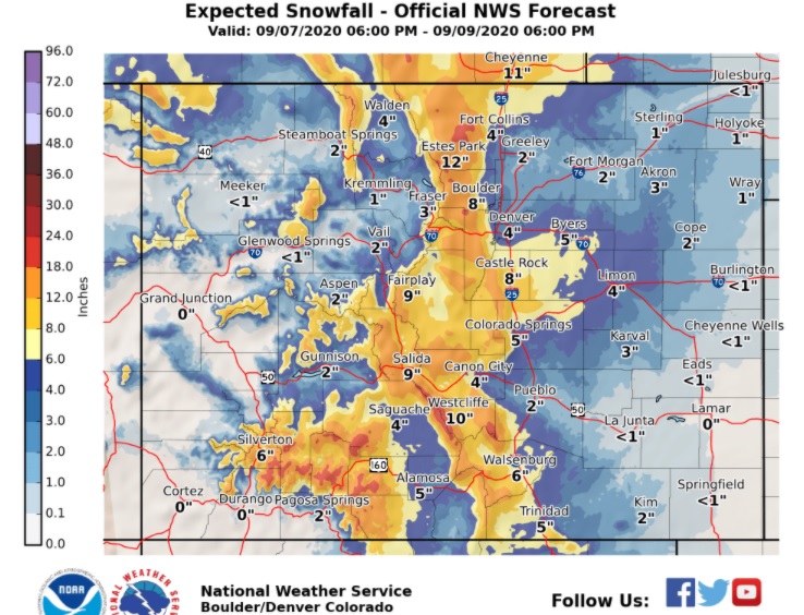
Here is the latest snowfall forecast from the National Weather Service:
You will not see many storms of this magnitude this early in the season in your lifetime. This is the earliest heavy snowfall by far that I have seen in the 10 years we have lived here. Enjoy the snow!